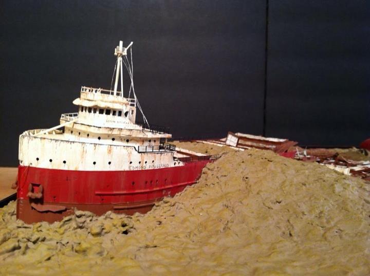
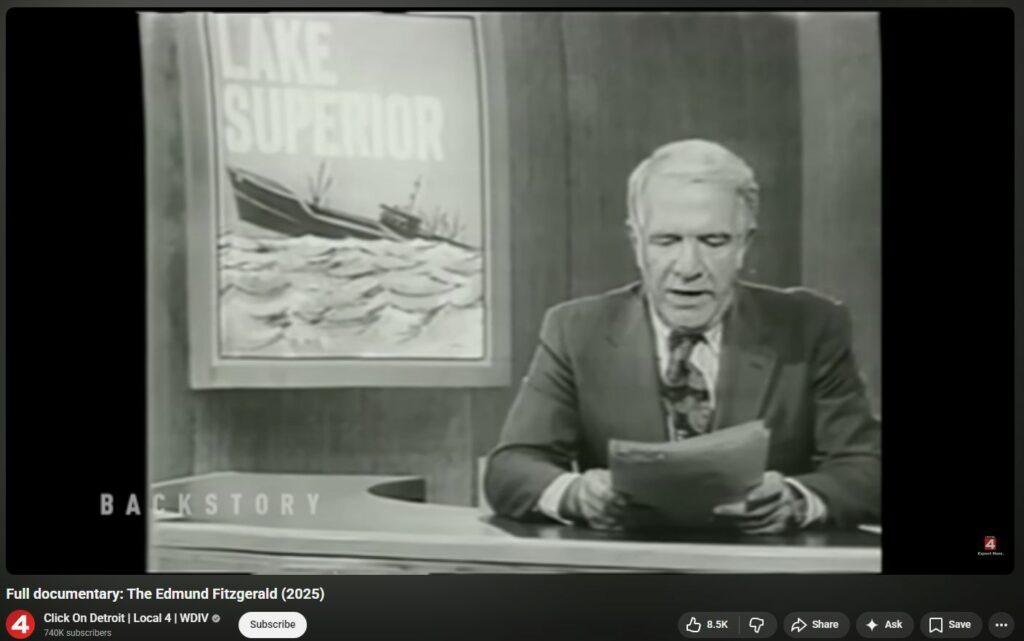
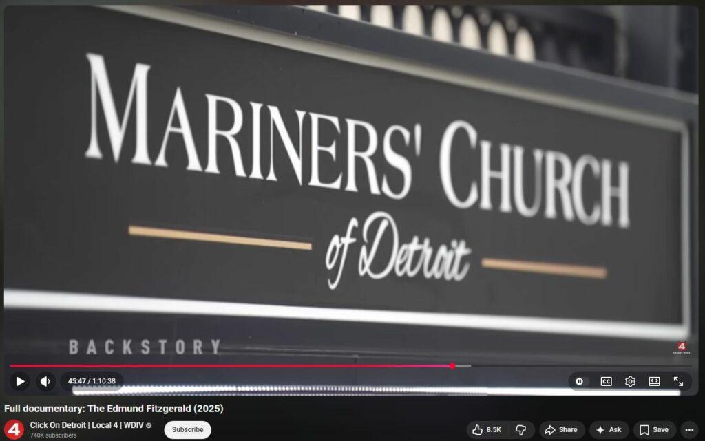
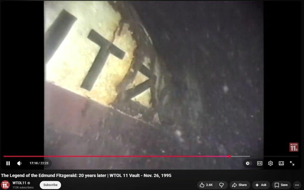
Edmund FitzgeralDEW
A Directed Energy Weapons (DEW) Attack fully describes all known evidence, including all anomalies. Why it was done, and by whom, remain unknown, but the evidence itself leaves all other theories, stories and explanations insufficient (and thus false) due to their inability to fully explain any of the many anomalies.
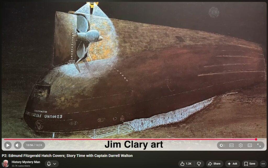
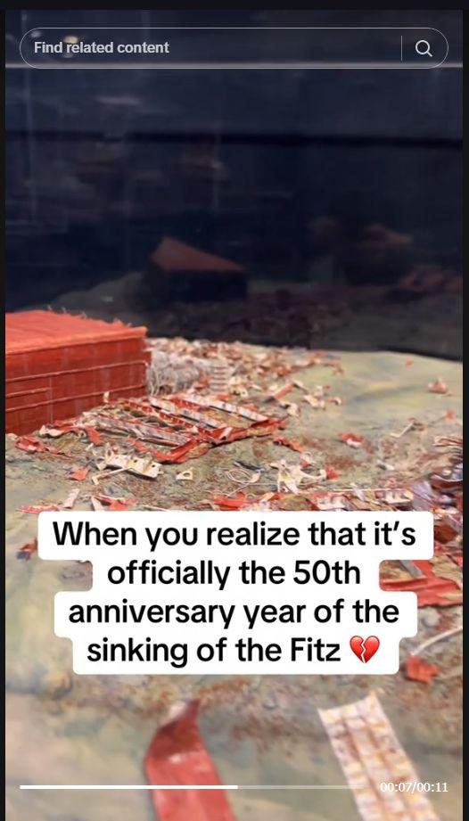
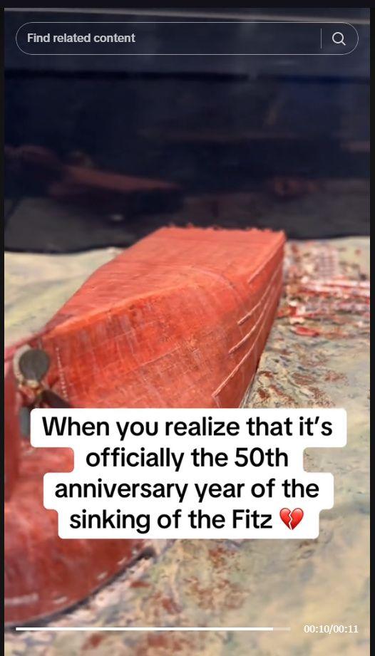
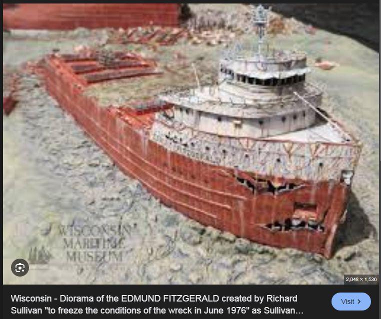
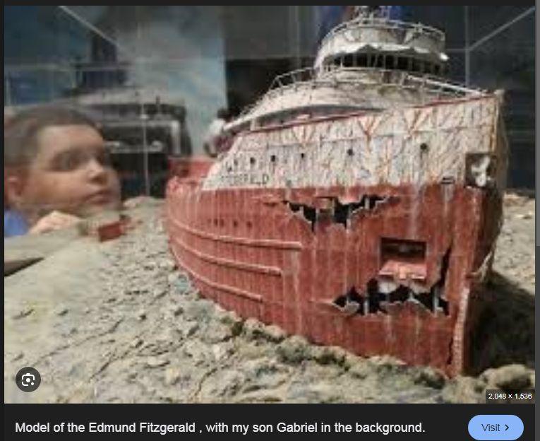
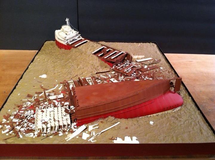
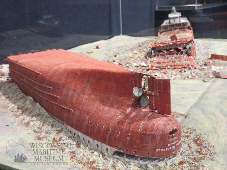
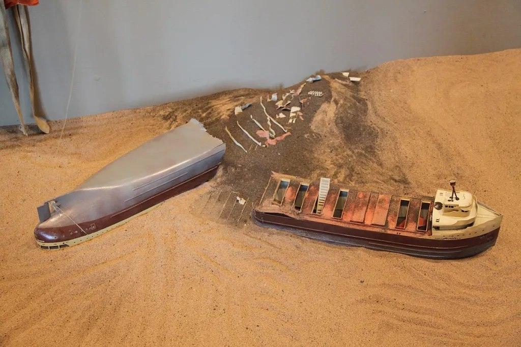
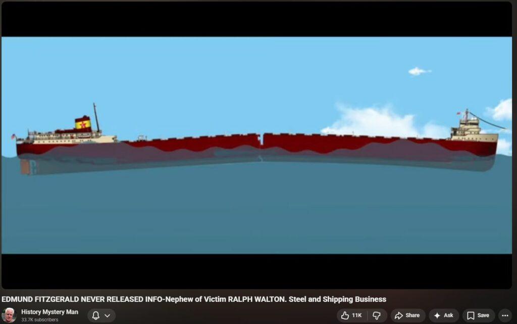
Fitz was broken into 3 large chunks, but the middle chunk, the middle one-third of the ship (200 feet long!) was somehow turned into powder. The only known mechanism of how that could have been done was introduced by Pres Reagan in 1983 – DE “WISH” has much more on its ORGanization site. Anything not focused on that verifiable “impossible” anomaly is just noise because it distracts from the fact that all other theories and explanations to-date absolutely fail to fully explain all existing, verified evidence, making all of them false because they insufficiently account for reality. What actually did happen is far darker, more diabolical than anyone has boldly explained, or even remotely hinted at – except one website. Check out DE “WISH” , it’s time to wake up to the awful reality.
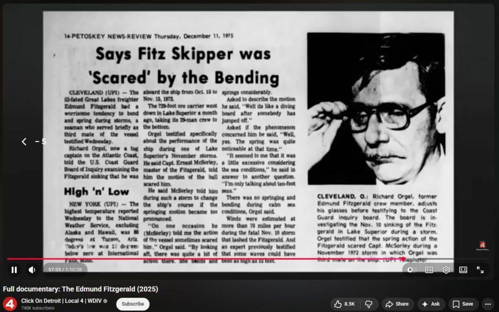
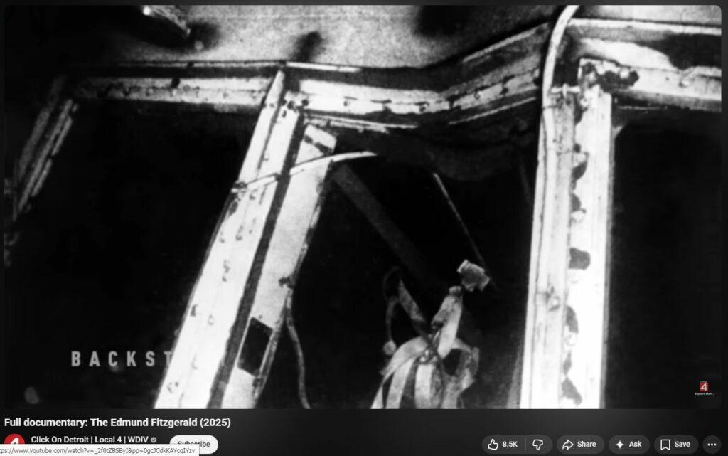
“Big Fitz was sunk by energy beam on purpose – probably a military test, possibly disaster capitalism, maybe for insurance. Energy beam (DEW) is what crinkled up so many massive hulks of its structural steel, bending it impossibly tightly while freezing cold with ZERO cracks anywhere. That’s what turned the center-third 200-feet of the entire ship into powder and confetti. That’s what massively gashed (twice or more!) the thickest part of the bow hull. That’s what imploded some hatch-covers and bent radically other hatch covers. That’s what strewn the taconite cargo over such a massive debris field. That’s what caused so much “insta-rust” prior to sinking. That’s what removed all the glass as if it had never been present. That’s what knocked out both RADARs. That’s why the military was very quickly on-hand with magnetic anomaly gear. The unprecedented (never before nor since) massive inland cyclone was also generated by RF tech, following military base RADAR along its entire birth in Oklahoma up the midwest. It’s also why the cold-kept crew corpses will show tell-tale skin-sloughing-off microwave radiation burns (and therefore must never be shown!) It’s also why further exploration of the site has been made so expensively (and highly arguably) illegal. It’s also why there is such long, ongoing deliberate attempt to obfuscate and confuse what really happened — keeping that exotic weaponry secret is of utmost priority to its continued use against humanity. The One Correct Theory must explain all known evidence including all anomalies and all future discoveries otherwise it is insufficient and therefore false. Energy beam is the only full explanation for 100% of what is known; EVERYTHING ELSE IS INSUFFICIENT, and anyone not pointing out loudly this simple fact is either dangerously misguided or diabolically intends to dupe you, too.”
RF Anomalies / DEW Hallmarks
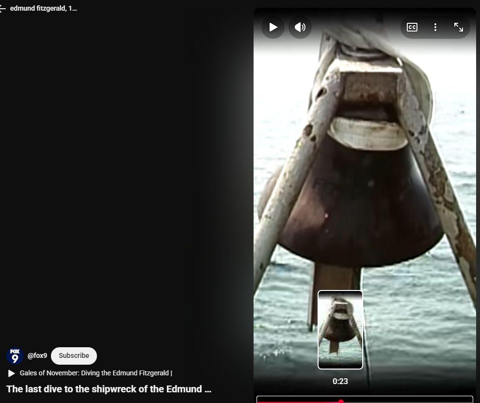
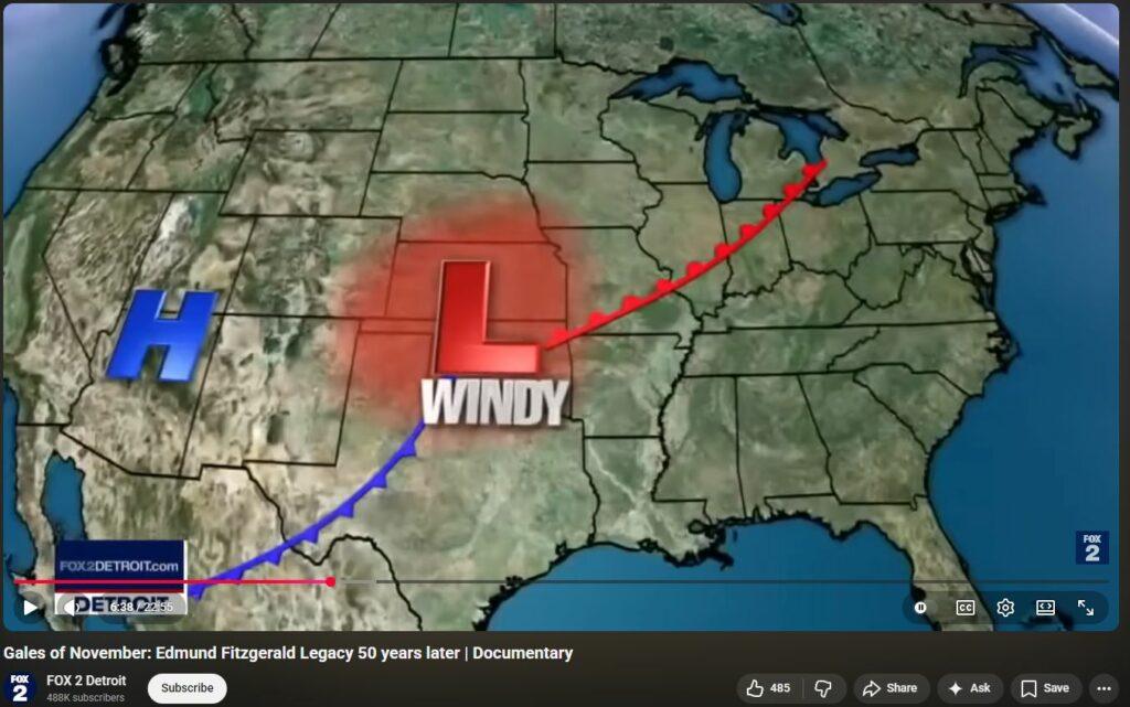
- Both Long and Short RADAR units on Edmund Fitzgerald were out of commission. Reason unexplained.
- Lighthouse at Whitefish Point was inoperable. The lighthouse was infamous for unfailing operation for 150 years until that night. Its outage was unprecedented.
- Radio beacon at Whitefish Point was inoperable. This makes it a double-whammy, and thus unlikely upon unlikely.
- (Above points from 18:55 in and 23:00 into video)
- Amazing inversion of weather conditions from earlier that day 10 Nov 1975.
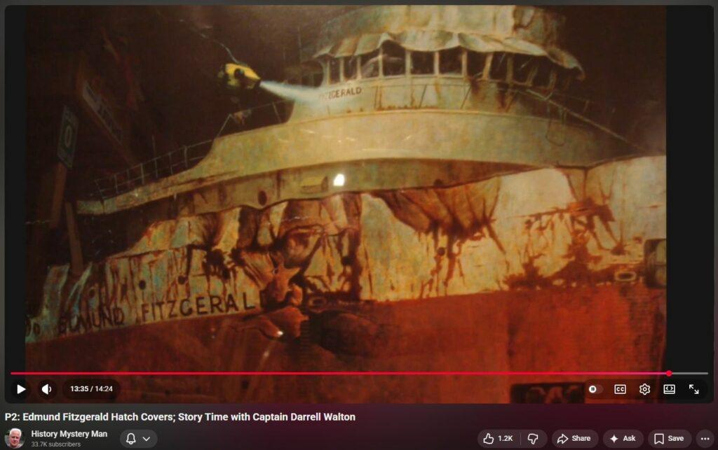
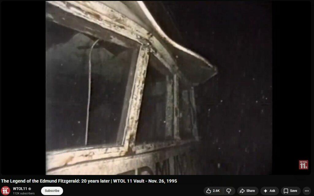
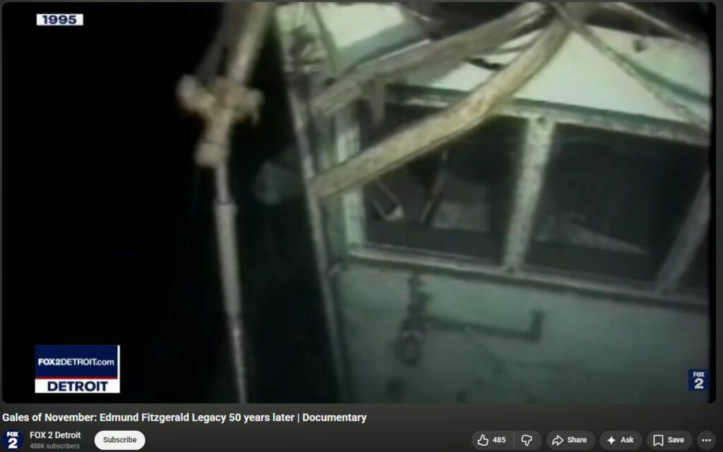
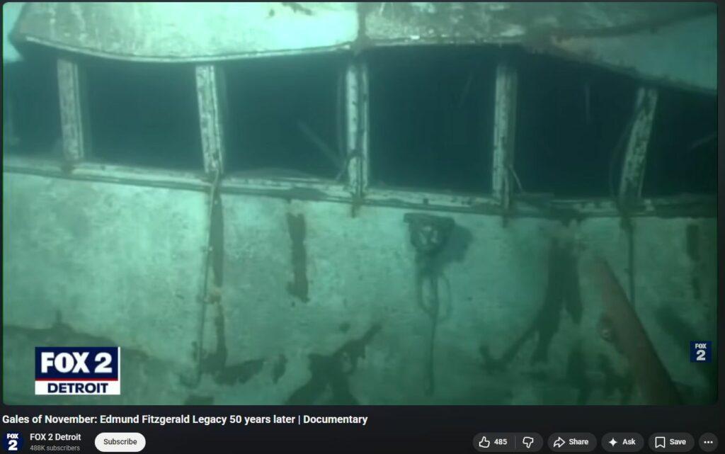
- All thick pilothouse glass vanished as if never present.
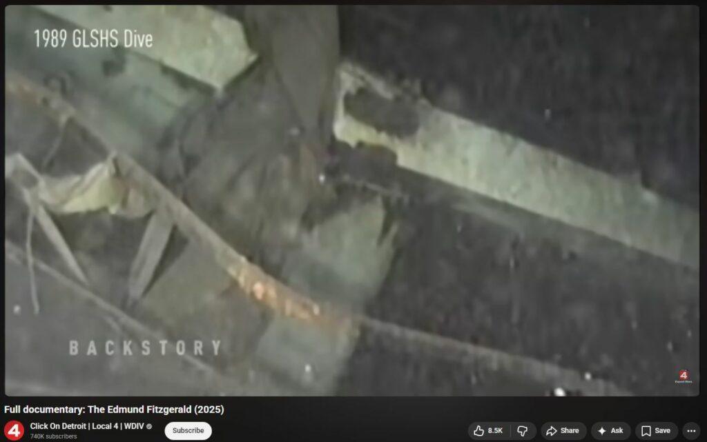
- Insta-rusted and melted/warped steel galore. Huge gashes, crumplings, of 18-inch thick steel.
- ARTHUR M ANDERSON (trailing ship) lost RADAR contact with EDMUND FITZGERALD in an instant.
- WhiteFish Point notorious for electromagnetic disturbances, anomalies. See below.
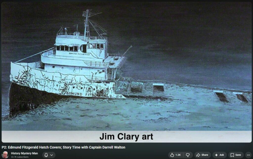
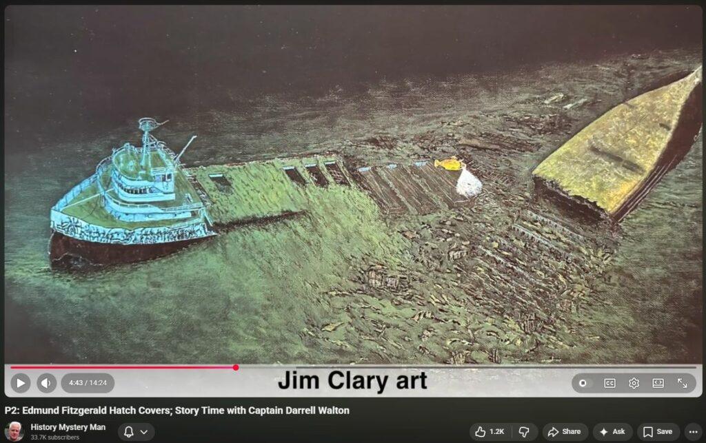
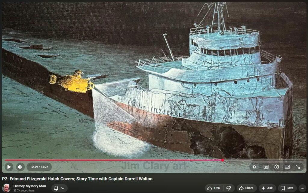
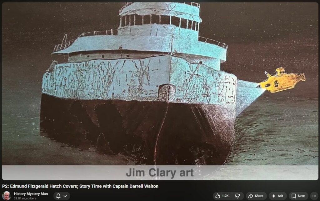
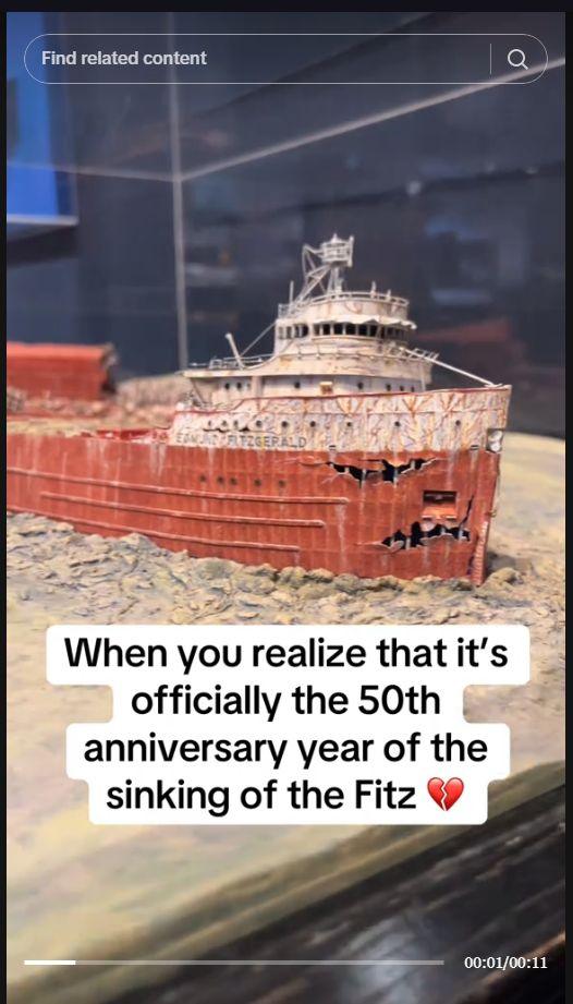
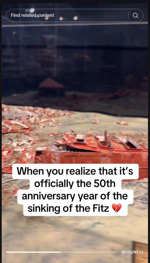
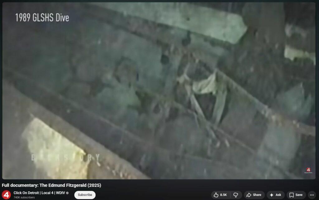
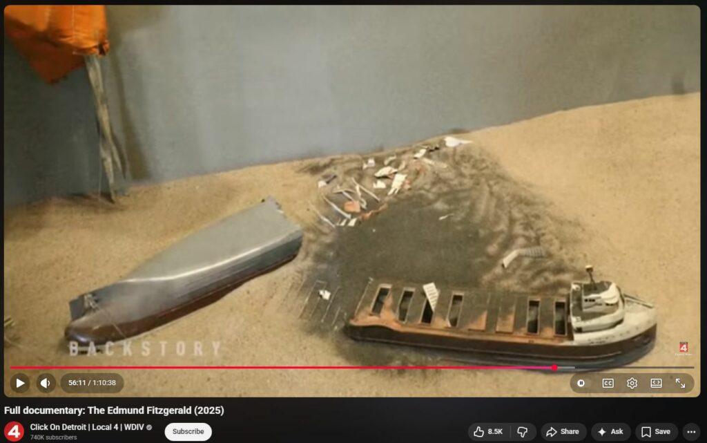
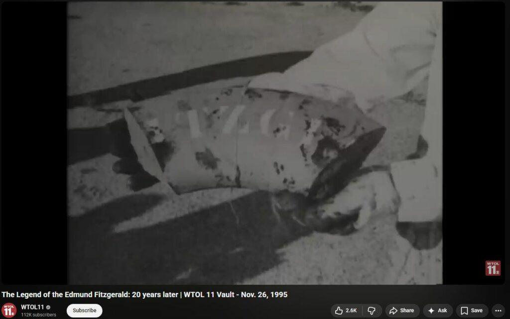
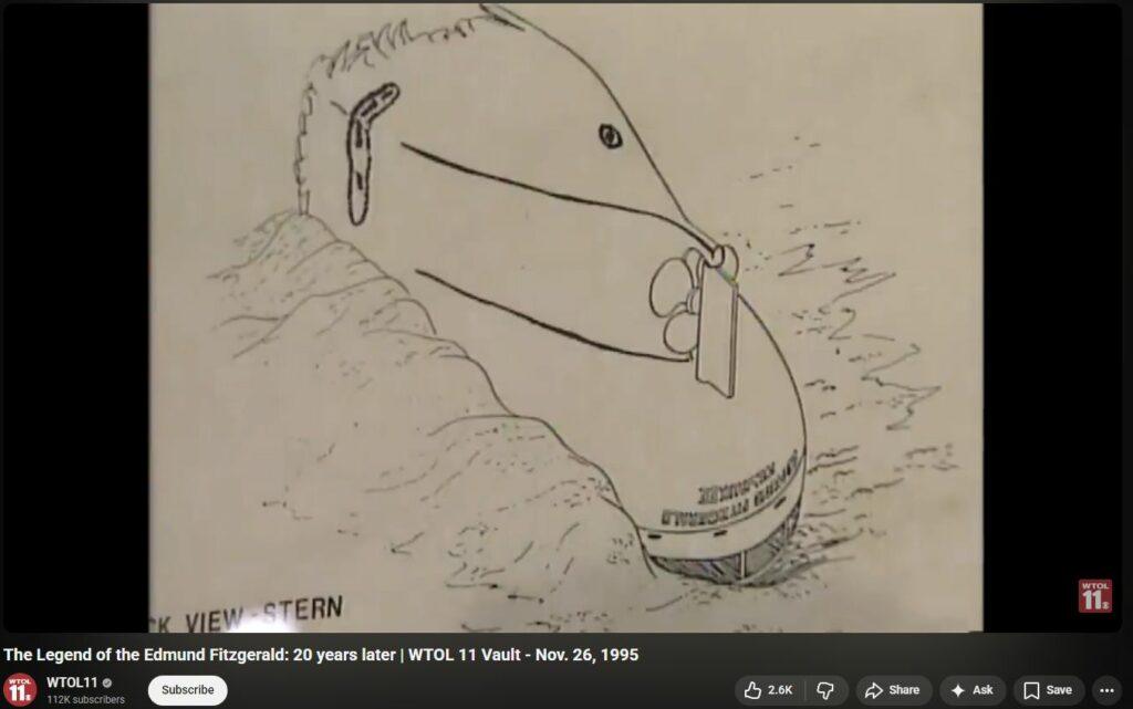
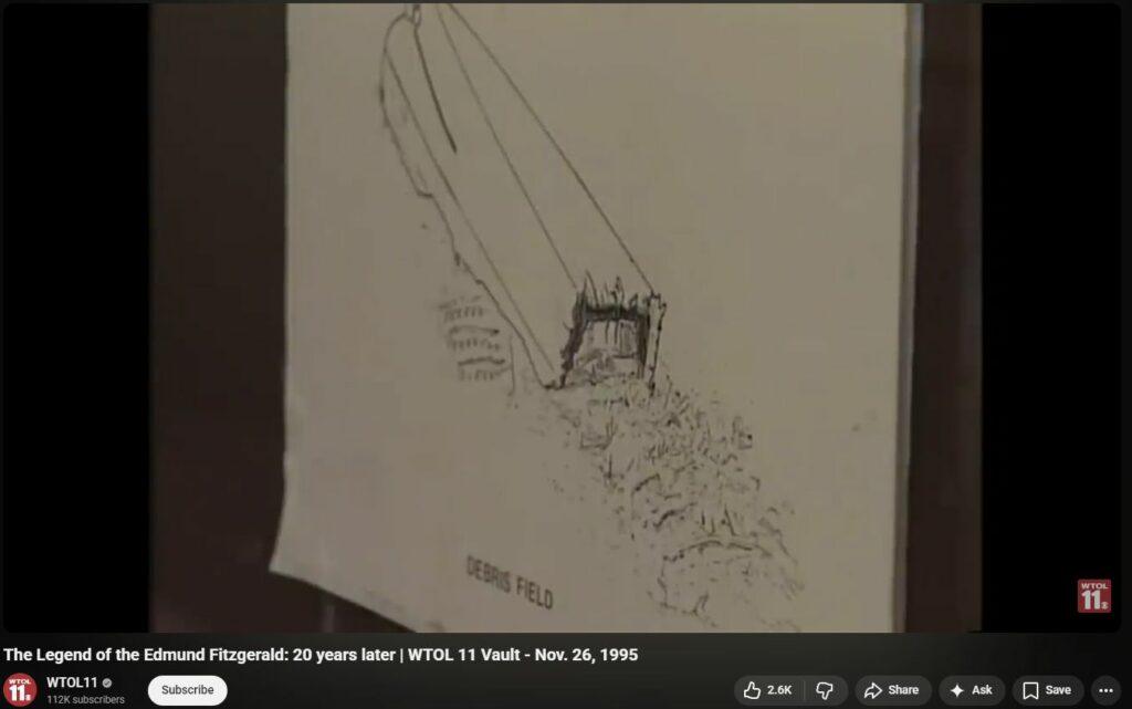
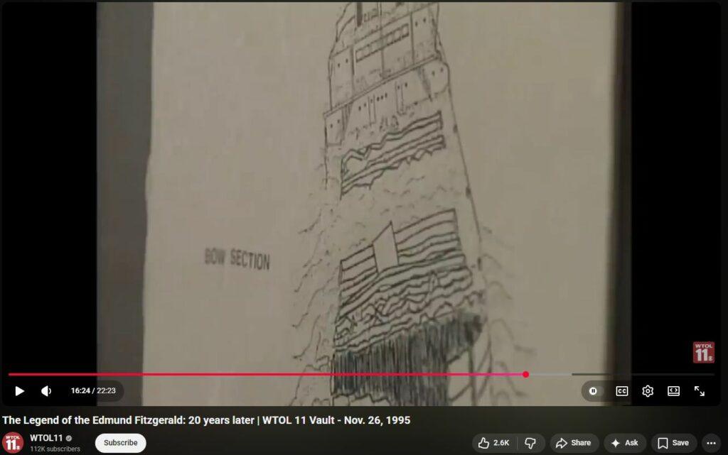
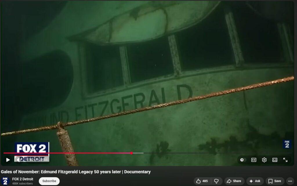
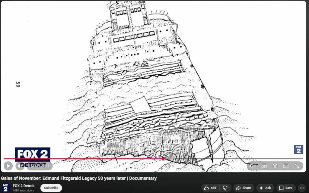
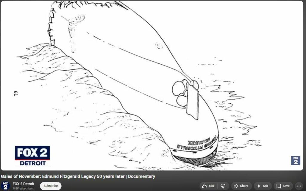
- Middle 1/3rd of the EDMUND FITZGERALD (200 feet) was dissolved into powder, seemingly similarly to how the WTC were “dustified” whilst in mid-air in NYC on 911, and perhaps by the same weaponry / mechanism.
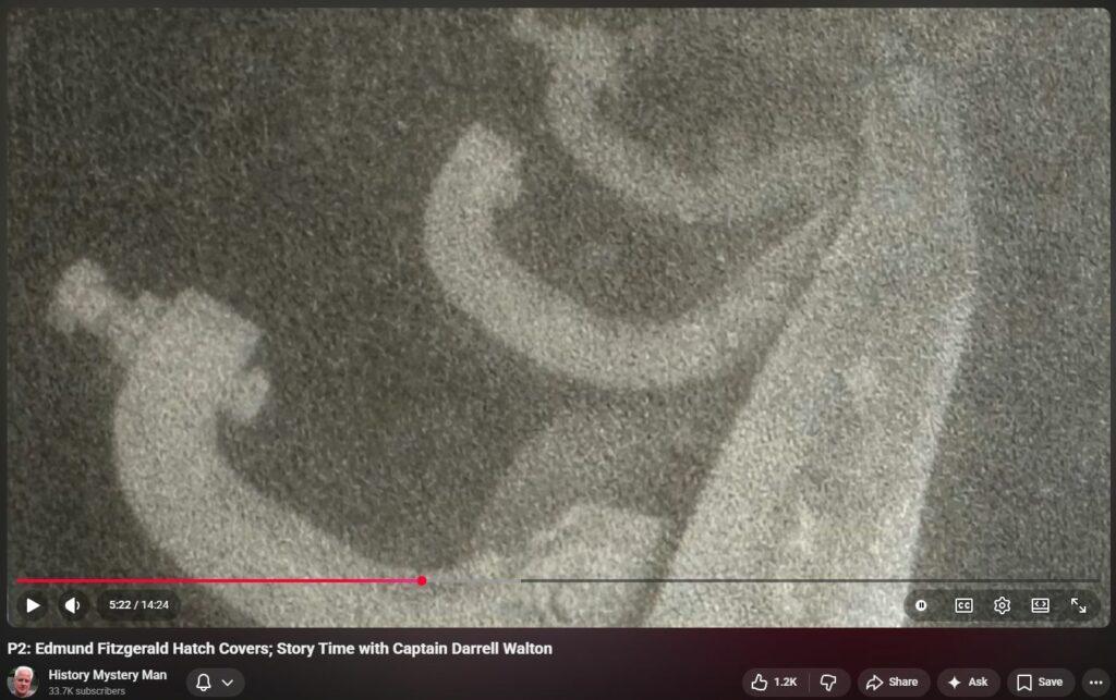
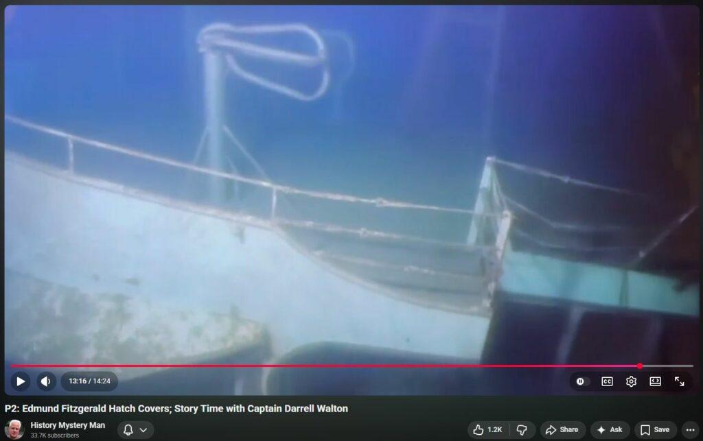
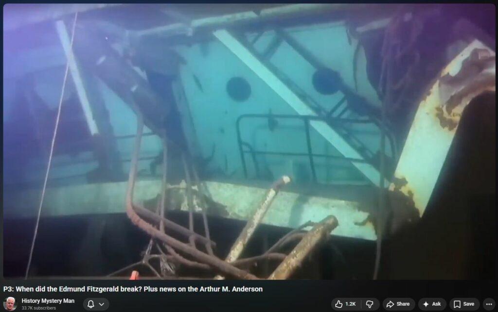
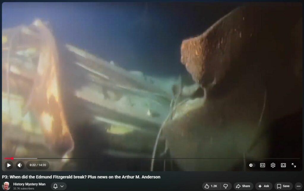
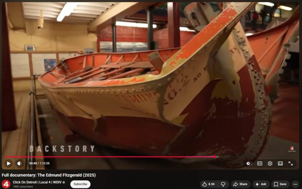
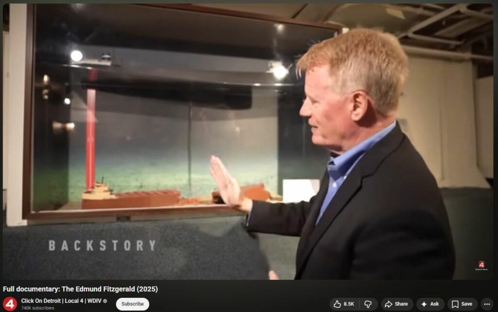
- Hatch covers #2 and #3 was found, appreciably bent, behind stern. 56:00 in
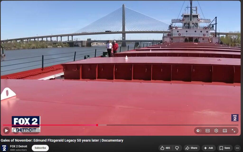
- Holds 1 and 2 are empty of taconite.
- US Navy plane first to locate wreck; US Navy ship first to dive at wreck. Military control.
Given that RF radiation “greys-out” the corneas (RF causes insta-cataracts), evidenced by Melissa Doi recorded call to 9-1-1 from WTC in NYC on 911 (and RF lethality studies on rats – RF kills by inflaming mucous membranes causing asphyxiating) and also similar recorded call by Kevin Cosgrove, it’s likely that one or more of the crew were insta-blinded. A prediction is that at least one of the bodies, like the ship, is perfectly preserved by the cold water, and yet it will evidence horrific microwave radiation burns — sloughing skin, red lesions, radiation damaged flesh.
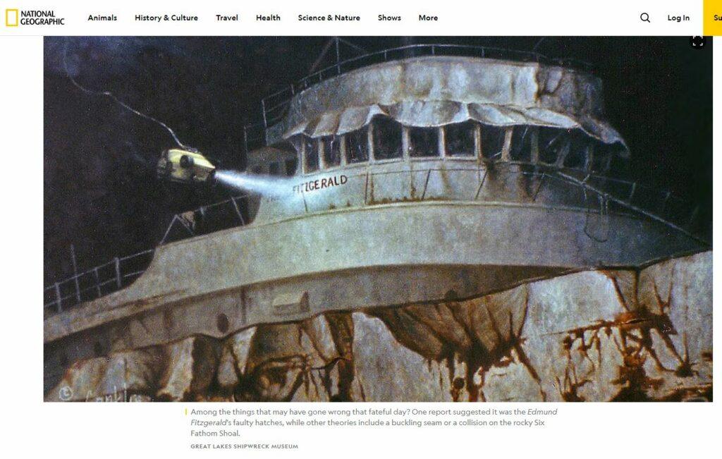
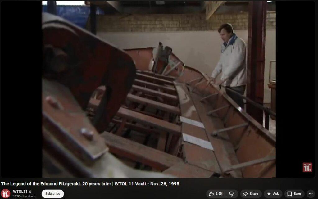
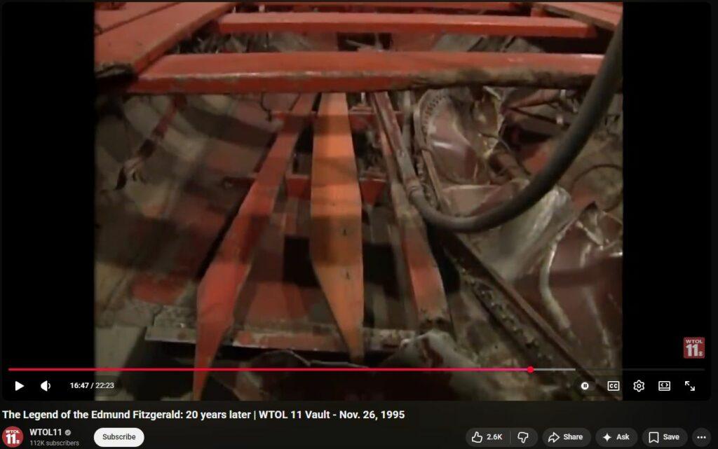
Unfortunately this “documentary” utterly avoids the massive gashes in the bow where 16-inch thick structural steel is “ripped like paper”. It also utterly avoids mentioning the 200-feet (the center one-third !) of the ship that was “dustified”, turned to dust, leaving no traces of existence beyond fragments and powder — in fact, in several places it goes out of the way to suggest/program how the ship “broke in two” when in fact the ship broke into two end pieces and about 50,000 other shreads that are, astonshingly, the remnants of the ship’s entire central body. Also not mentioned is the strong window glass vanished as if never present. These critical omissions stain this 2025 effort as propaganda, mislead, (likely) Jesuit subterfuge.
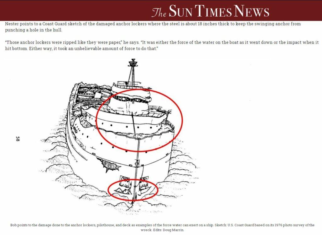
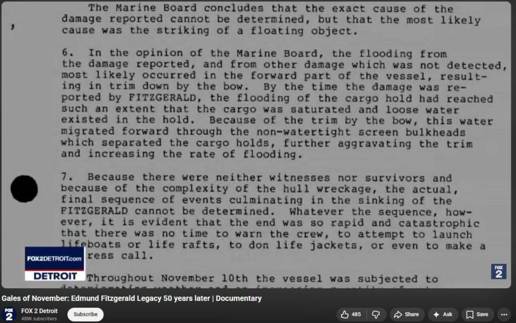
4:00 into https://www.youtube.com/watch?v=5XQW85TMYKg — US Navy Report: “#1 hatch cover was entirely inside the #1 hold and showed indications of buckling from external loading.” If DEW had crinkled, warped, jellified, weakened the steel hatch cover, this would also much more plausibly explain the evidence. “#2 hatch cover was missing and cowling buckled. Hatch covers 3, 4 apparently covered by mud, portion of #3 could be seen (so this pre-counters the claim of the Ric Mixter guy). Hatch cover #5 was missing. Series of 16 consecutive hatch-cover (“Kestner”) clamps on #5: 1st and 8th were distorted or broken, all the others were undamaged and in the open position.”

10:00 — talk about 200 missing feet of ship — https://www.youtube.com/watch?v=5XQW85TMYKg

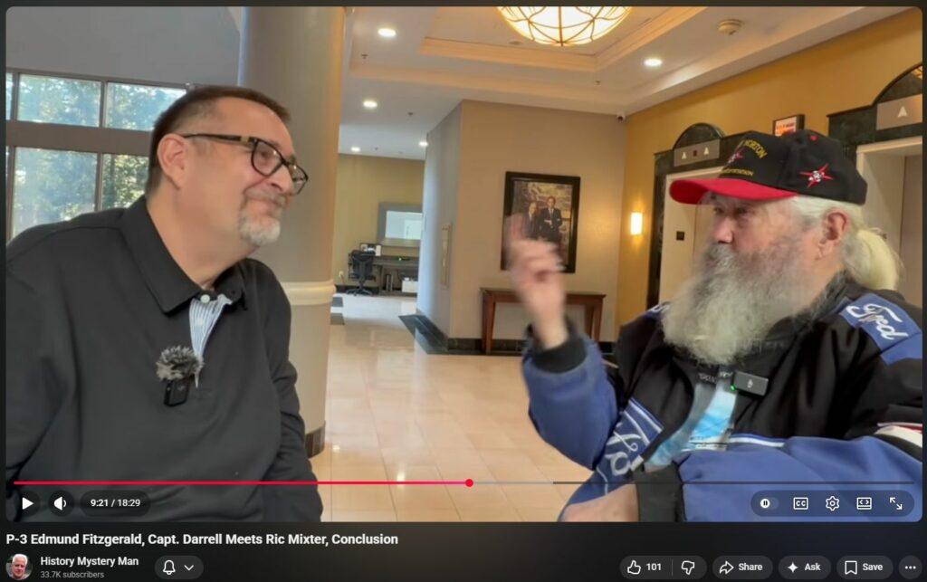
“How can you trust anything the Government says? The difference Conspiracy Theory and Fact is about six months any more.” — Capt Darrell Walton 11:15 into https://www.youtube.com/watch?v=5XQW85TMYKg
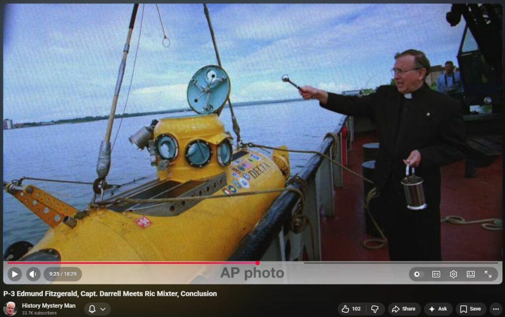
Discussing the near-perfect preservation of objects sunk in Great Lakes. “They’re clean”. “You can see pictures of ships that sank in the Great Lakes a hundred years ago: Other than the zebra-mussels on them, they look like the day they sank.” 12:30 in
Titanic also melted by DEW.

Description of ships compass spinning wildly: 9:00 into https://www.youtube.com/watch?v=GiI2Kbkkukk — “Did you hear what Ric Mixter just said? …that his compass was just [whirling widlly].”
Jesuit presence even to modern day. Raytheon, maker of DEW, board of directors controlled by Jesuits. Jesuit motto: Go forth and set the world on fire.
Ric Mixter: 4 wrecks undiveable: Hamilton and Scourge are two from War 1812. Edmund Fitzgerald. USS Arizona (Pearl Harbor).


Unfortunately though perhaps expectedly, by its end the “documentary” ends up presenting supposed triumph of emotion over reason, when in fact it is still not known with certainty exactly what happened to the EDMUND FITZGERALD. The powderized missing one-third of the ship is overwhelmingly compelling evidence of Directed Energy Weapons involvement in the take-down. Why it was done, and Who did it are questions that can be answered only after it is known what was actually done.
It seems most likely to some wary minds that this event was manufactured and manipulated over the decades also into evoking “law” that “illegalizes” respectful, free-inquiry, leveraging one or a few outspoken persons with “hurt feelings” etc to block from humanity attainable and important knowledge.


“EDMUND FITZGERALD was the last ship to [sink] on the Great Lakes. 6,000 [ships sank]: 1875 to 1975, but not one since the ES.” 1:04:39 in — That is 60 sinkings per year, or more than one per week for a century. That’s one helluva attack-vector against economic engine, Middle Class, etc. One wonders, “How many sinkings were due to DEW?” The Vatican, the “elite” think and reason and operate on this grand scale; ALL the rest is merely noise, collateral, means to Their ends.
Whitefish Point Bay – Bermuda Triangle 2.0
Analysis of Geophysical and Electromagnetic Anomalies in the Whitefish Point-Whitefish Bay Corridor
The region encompassing Whitefish Point and Whitefish Bay in eastern Lake Superior represents one of the most geophysically active and electromagnetically anomalous zones in North America. Known historically as the Graveyard of the Great Lakes, the area has long been the subject of reports involving the total failure of navigational suites, the erratic behavior of magnetic compasses, and the inexplicable “fritzing” of electronic systems. While folkloric interpretations often attribute these events to the so-called Great Lakes Triangle or paranormal energy vortexes, a rigorous scientific examination reveals a complex interplay of Proterozoic tectonic structures, high-intensity mineral deposits, and unique atmospheric refractive conditions. This report explores the mechanisms driving these phenomena, expounds upon the historical and modern accounts of instrument failure, and explains the underlying geophysical framework that defines this treacherous maritime corridor.
The Tectonic Architecture of the Lake Superior Basin
To understand the electromagnetic environment of Whitefish Point, one must first analyze the deep-crustal history of the Midcontinent Rift System (MRS). Approximately 1.1 billion years ago, the North American continent began to split along a 2,000-kilometer arc extending from Kansas through Lake Superior and into Michigan. This rifting event facilitated the extrusion of massive volumes of basaltic magma from the mantle, which cooled to form the bedrock of the eastern Lake Superior region.
Keweenawan Volcanism and Crustal Thinning
The geological framework of the Whitefish Bay area is dominated by the Keweenawan Supergroup, a sequence of volcanic and sedimentary rocks that reached thicknesses of up to 12,000 feet. During the initial phase of the trough’s development, tensional forces perpendicular to the axis of the rift caused significant crustal thinning. As the continent rotated counter-clockwise, basic mantle material was intruded into the upper crustal layers and extruded as flood basalts into the central portion of the Lake Superior syncline.
These basalts are not uniform; they are characterized by extreme density and high concentrations of iron-bearing minerals, specifically magnetite (Fe3O4). The structural configuration of the southeastern shoreline of Lake Superior is described as serrated, with an en echelon sequence of positive gravity anomalies marking the path of the Mid-Michigan Gravity High. This structural complexity suggests transcurrent movements and complex faulting that have left a permanent mark on the local magnetic and gravitational fields.
The Whitefish Point Horst and Structural Anomalies
A primary driver of the anomalous phenomena at Whitefish Point is the presence of a structural feature known as a horst—a block of the Earth’s crust that has been upthrown between parallel faults. Geophysical investigations indicate a major linear positive gravity anomaly trending south from Whitefish Point, which is associated with these upthrown Middle Keweenawan basalts. This horst is positioned within the eastern limb of the Lake Superior syncline and correlates with the volcanics outcropping on Mamainse Point, Ontario.
| Geologic Feature | Composition | Structural Role | Associated Anomaly |
| Whitefish Point Horst | Upthrown Middle Keweenawan Basalts | Defines eastern limb of syncline | Positive Gravity/Magnetic High |
| Lake Superior Trough | Clastic Sediments & Flood Basalts | Central rift depression | Regional Gravity Minimums |
| Mamainse Point Extension | Rift-related Volcanic Rocks | Continuation of rift limb | 800-gamma Aeromagnetic Anomaly |
| Michipicoten Island | Mafic Volcanic Sequences | Thrust fault associated feature | 1,000-gamma Aeromagnetic Anomaly |
The interface between the high-density volcanic rocks of the horst and the overlying Upper Keweenawan clastic sediments creates sharp gradients. Interpretive results from two-dimensional model studies suggest that the syncline in this eastern portion of the Northern Peninsula is faulted into a horst specifically in the Whitefish Bay area. This localized upthrusting brings magnetic-rich basement rock closer to the surface, significantly increasing the local magnetic field intensity and creating the conditions necessary for compass deviation.
Mineralogical Drivers of Electromagnetic Disturbance
The “weird” electromagnetic phenomena reported by mariners—specifically “spinning” compass needles—are fundamentally linked to the mineralogical composition of the Lake Superior iron ranges. The region is historically recognized as the “Birthplace of North American Precambrian Geology” due to its world-class deposits of native copper and iron ore.
Magnetite and Remanent Magnetization
Magnetite (Fe3O4) is the most abundant metal oxide in the Keweenawan basalts and is the only common mineral that is naturally magnetic. Its crystal structure contains both ferrous (Fe+2) and ferric (Fe+3) ions, and a complex pattern of electrons between these two forms is the source of its magnetic nature. In the Whitefish Point region, magnetite occurs both as microscopic crystals dispersed throughout igneous rocks and in massive deposits known as lodestone.
A critical factor in the erratic behavior of navigational instruments is remanent magnetization. As the volcanic rocks of the Midcontinent Rift cooled, the magnetite within them aligned with the Earth’s magnetic field at that time. However, paleomagnetic studies of features like Superior Shoal have shown that these rocks often possess reverse-polarity remanence, meaning their internal magnetic field is oriented opposite to the Earth’s current field.
| Iron Mineral | Chemical Formula | Magnetic Property | Primary Occurrence |
| Magnetite | Fe3O4 | Strongly Ferrimagnetic | Basalts, BIFs, Heavy Sands |
| Hematite | Fe2O3 | Weakly Ferromagnetic | Oxidized Iron Ranges |
| Goethite | FeO(OH) | Antiferromagnetic | Bog Iron, Limonite |
| Siderite | FeCO3 | Paramagnetic | Sedimentary Carbonates |
The presence of massive magnetite deposits can play havoc with compasses because the local magnetic field—the vector sum of the Earth’s global field and the rock’s remanent field—can vary sharply over short distances. If the remanent field of an underwater horst is strong enough and oriented at an angle to the current magnetic north, a magnetic needle will experience a torque that causes it to deviate or, in cases of extreme gradient, appear to spin as the vessel passes through shifting field lines.
Banded Iron Formations (BIFs) and Sedimentary Deposits
In addition to volcanic basalts, the Whitefish Bay area is influenced by Banded Iron Formations (BIFs), which consist of alternating layers of iron oxides and silica (chert). These formations, primarily 1.8 to 2.5 billion years old, were created when photosynthetic microorganisms flourished in oxygen-poor oceans, precipitating iron from the water. Chert and magnetite are the most common minerals in these formations.
In Early Proterozoic sedimentary rocks, magnetite occurs in large deposits that were originally discovered and mapped solely by their impact on compass readings. Before the introduction of the dip needle in 1865, explorers had to use sun compasses because the local magnetic variations were too “difficult to interpret”. The “magnetic method” remains the standard for mapping the region’s ore deposits because the Precambrian bedrock is largely obscured by glacial drift and the waters of Lake Superior.
Historical Accounts of Instrument Failure and Compass Deviation
The history of Whitefish Point is replete with accounts of navigational failure that coincide with the region’s most famous shipwrecks. Collisions in fog, blinding snow, and “poor communications” are frequently cited as the official causes of these disasters, but the underlying role of electromagnetic interference is a recurring theme.
The Evolution of Navigational Challenges
For nearly two centuries, mariners have battled the “angular variations” of the magnetic field in the Lake Superior region. Historical documentation notes that magnetic mapping was directed at identifying regions favorable for iron ore, using simple magnetic needles that would oscillate vertically in the magnetic meridian—a tool known as the dip needle. The fact that such specialized instrumentation was required to map the region underscores the inherent unreliability of standard horizontal compasses in the vicinity of Whitefish Point.
In the 19th century, numerous ships rounded Whitefish Point only to find their situational awareness compromised. The Comet (1875) and the John B. Cowle (1909) both suffered catastrophic collisions in fog. While weather is the primary factor, the “misjudged direction” of approaching vessels reported by survivors suggests that standard navigational aids may not have been providing accurate headings. In the case of the Comet, which carried 500 tons of pig iron and 70 tons of silver ore, the presence of its own metallic cargo may have exacerbated the local magnetic deviations caused by the Whitefish Point horst.
The SS Edmund Fitzgerald: A Case Study in System Failure
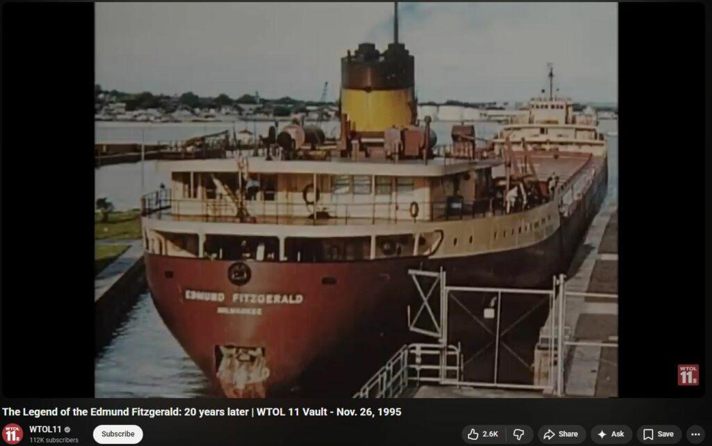
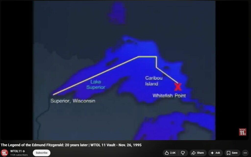
The most prominent example of navigational instrument failure in the region is the loss of the SS Edmund Fitzgerald on November 10, 1975. While the ship was battling a severe winter gale with waves of 18 to 25 feet, the sequence of events leading to its disappearance was precipitated by the total failure of its radar system.
| Time (EST) | Event Description | Source |
| 1:00 PM | Fitzgerald encounters 52-knot winds and 10-foot waves | |
| 3:30 PM | Captain McSorley reports topside damage and a list to the SS Arthur M. Anderson | |
| 4:10 PM | Fitzgerald’s radar becomes inoperable due to wind or equipment failure | |
| 4:30 PM | McSorley slows down to close the range with the Anderson for radar guidance | |
| 7:10 PM | Final radio contact: “We are holding our own.” | |
| 7:15 PM | Fitzgerald disappears from the Anderson’s radar screen |
The radar failure forced the Fitzgerald to rely on the Anderson for navigational assistance during a period of zero visibility. A leading hypothesis for the sinking—the shoaling hypothesis—suggests that without operational radar or reliable navigational aides, the Fitzgerald unknowingly passed over the Six Fathom Shoal north of Caribou Island, raking its hull and causing the slow flooding that eventually led to its loss. The failure of the radar in such a critical moment is often attributed to “the tempest,” but the susceptibility of electronic systems to the region’s electromagnetic profile remains a point of investigation.
Magnetic Detection and Wreck Discovery
The very magnetic properties that cause “spinning compasses” were ultimately used to locate the remains of the Edmund Fitzgerald. On November 14, 1975, a U.S. Navy aircraft equipped with a Magnetic Anomaly Detector (MAD) located a strong magnetic contact 17 miles north-northwest of Whitefish Point. This device, designed to detect the magnetic distortion caused by large steel hulls, identified the wreck’s position in 530 feet of water. This highlights the binary nature of the Whitefish Point environment: the same magnetic intensity that foils navigation also provides the primary means of sub-surface detection.
Atmospheric Refraction and “Electronic Fritzing”
Beyond the subterranean and mineralogical influences, the Whitefish Bay area is prone to atmospheric phenomena that interfere with electromagnetic wave propagation. This includes both visible light (mirages) and high-frequency radio waves (radar interference).
The Superior Mirage and Radar Ghosting
A “Superior Mirage,” also known as a Fata Morgana, occurs when a layer of cold air is trapped beneath a layer of warmer air—a common occurrence over the cold waters of Lake Superior. This temperature inversion causes light rays to bend downward, following the curvature of the Earth. This allows observers to see objects that are physically located below the horizon, often appearing elevated, distorted, or “floating”.
Historical records from the 16th century and earlier describe these shapes as “animals of every kind” or “floating cities” seen in the sky. In a modern context, this atmospheric lensing affects radar beams in a process known as anomalous propagation (AP). Under these conditions, a radar beam can be refracted directly into the ground or water, resulting in “sea return”—intense-looking echoes that obscure actual targets on the radar screen.
The first mate of the Arthur M. Anderson reported “losing sight of the Fitzgerald on the radar from sea return” just before the vessel sank. While the massive waves of the storm were the likely source of the reflection, the presence of an atmospheric inversion could have amplified the interference, effectively blinding the Anderson‘s navigational suite at the moment the Fitzgerald foundered.
Localized Electronic Failures in Modern Infrastructure
The reports of “fritzing” are not limited to maritime vessels; they extend to the modern digital infrastructure of Whitefish Bay. For instance, the Whitefish Bay Public Library recently reported the failure and discontinuation of its fire detection system’s control panel, specifically citing potential “wire failure, circuit board failure, and motherboard failure”. Local businesses specializing in the repair of game consoles, smartphones, and computers in Whitefish Bay handle frequent cases of “power supplies going kaput” or “motherboards having a meltdown”.
While many of these failures are attributable to the standard service life of electronic components, the regional geophysical profile suggests that sensitive micro-electronics may be subject to heightened environmental stress. In areas of high magnetic gradient, the movement of conductive materials through the field can induce small electromotive forces (EMF) according to the formula:
∮E⋅dl
=−dtd∬B
⋅dA
In the presence of the 60,000-gamma magnetic field variations recorded during aeromagnetic surveys of the Lake Superior trough, unshielded or aging electronic systems may experience increased rates of “glitching” or circuit degradation.
Gravimetric Flux and Seismic Interaction
The gravity anomalies at Whitefish Point provide a deeper understanding of the crustal stresses that might influence the region’s electromagnetic environment. The Bouguer Anomaly Map indicates two local gravity minimums in the Whitefish Bay area, interpreted as thick accumulations of clastic sediments that have filled the rift’s depressions.
Crustal Thinning and Magnetic Intensity
The aeromagnetic survey of eastern Lake Superior recorded over 20,000 miles of flight lines using a digital recording proton precession magnetometer. This survey revealed that the magnetic data generally supports the geological interpretation of thick accumulations of flood basalts and clastic sediments. The sinuous shape of the trough and the serrated configuration of the southeastern shoreline indicate transcurrent movements resulting from crustal thinning.
These movements create a “Lake Superior Rift System” characterized by tensional forces that allowed vast amounts of basic material to be intruded into the upper crust. This intrusion of mantle material—rich in iron and other metals—acts as a massive, buried antenna that can interact with the Earth’s ionosphere and magnetosphere during solar events.
Geophysical Anomalies and Navigational Hazards
| Anomaly Designation | Magnitude | Geological Source | Impact on Navigation |
| Superior Shoal Anomaly | 1,200 gammas | Buried Volcanic Center | Major Compass Deviation |
| Marathon Anomaly | Variable (High Gradient) | Coldwell Alkaline Complex | Local Signal Disruption |
| Michipicoten Anomaly | 1,000+ gammas | Mafic Volcanic Sequence | Radar Signal Attenuation |
| Mamainse Point Anomaly | 800 gammas | Keweenawan Rift Volcanics | General Instrument Noise |
The presence of these high-amplitude positive anomalies indicates that Whitefish Point is not a magnetically “quiet” zone. For a vessel attempting to maintain a course via dead reckoning or visual pilotage, the sudden transition from a gravity minimum (sediment-filled basin) to a gravity high (basaltic horst) can coincide with a sharp shift in magnetic intensity, leading to the “spinning needle” phenomenon and the potential loss of navigational instruments.
Cultural Interpretations and the “Triangle” Concept
The persistence of maritime mysteries in the region has given rise to the concept of the “Great Lakes Triangle” or the “Bermuda Triangle of the North”. Popularized by Jay Gourley’s 1977 book, this concept attempts to link shipwrecks, plane crashes, and reported UFO sightings to “unexplained circumstances”.
The Role of Magnetic Declination and Deviation
Proponents of the paranormal theory often point to the “energy vortexes” and “ley lines” as the cause of disappearances in Lake Michigan and Lake Superior. However, even within these theories, there is an acknowledgment of the role of magnetic anomalies. Experts note that magnetic declination (the difference between true north and magnetic north) in Lake Michigan averages four to five degrees westward.
In the Whitefish Point area, magnetic deviation (errors induced in compasses by local magnetic fields) is the far more likely culprit. If a mariner holds a compass near a magnetic object—or in this case, sails over a massive magnetite-rich horst—the needle will point toward the local source rather than magnetic north. This “simple” error, when combined with the lack of visual clarity in a Lake Superior storm, is sufficient to explain the majority of “mysterious” vanishings.
UFO Sightings and Radar Anomalies
Reports of Unidentified Flying Objects (UFOs) and Unidentified Submerged Objects (USOs) in the Great Lakes Triangle are frequently cited as evidence of extraterrestrial involvement. From a geophysical perspective, these sightings often coincide with periods of “anomalous propagation” on radar. When a radar beam is bent by a temperature inversion, it can detect “traces” of high-powered electromagnetic fields or create “ghost images” that appear to move at incredible speeds. These “radar/visual cases” comprise about 20% of all reported UFO sightings and are directly linked to the atmospheric refractive conditions described as the Fata Morgana.
Modern Geophysical Mapping and Mitigation
The “weird” phenomena of Whitefish Point are increasingly being demystified by modern surveying techniques. The Great Lakes Shipwreck Historical Society (GLSHS), in collaboration with Marine Sonic Technology, uses side-scan sonar and transducer arrays to map the lake floor and detect objects with acoustic pulses. These systems are largely immune to the magnetic anomalies that affect traditional needles.
Lidar and Bathymetric Modeling
The National Oceanic and Atmospheric Administration (NOAA) has recently completed topobathy lidar surveys of the Whitefish Point corridor. By using airborne lasers to measure the distance between the aircraft and the lake floor, NOAA can build high-resolution Digital Elevation Models (DEMs) that cover the area from Whitefish Point to Bay Mills. These models allow mariners to identify critical priority areas and benthic habitats while avoiding the dangerous shoals that have historically led to instrument-reliant vessels grounding.
The Continued Unpredictability of the Syncline
Despite these advances, the Lake Superior syncline remains a challenging environment. The “Flying Dutchman of Lake Superior”—the SS Bannockburn—is said to still be seen in the storms and heavy fog of the eastern lake, a legend fueled by the persistent atmospheric mirages of the region. The search continues for the Annie M. Peterson, a schooner barge lost in a 1914 storm that claimed three ships and 28 lives. These enduring mysteries are a testament to the lake’s “wrath” and the geophysical complexity of the Shipwreck Coast.
Conclusion
The electromagnetic phenomena of Whitefish Point—ranging from the historical “sun compass” requirements to the modern “fritzing” of electronic circuits—are the result of a rare convergence of geophysical factors. The upthrown basalts of the Whitefish Point horst, rich in magnetite and characterized by reverse-polarity remanence, create a localized magnetic field that differs sharply from the global average. When these magnetic gradients interact with the atmospheric refractive conditions of the Lake Superior temperature inversions, the result is a navigational environment where compasses deviate, radar signals ghost, and visual situational awareness is compromised by mirages. The legacy of the SS Edmund Fitzgerald and the hundreds of other wrecks along the Shipwreck Coast is not one of paranormal malevolence, but of the formidable power of the Midcontinent Rift System and the inherent vulnerability of human technology within such a high-intensity geophysical corridor. Understanding these mechanisms is essential for the continued safety of Great Lakes maritime traffic and the ongoing exploration of North America’s Proterozoic past.
Sources used in the report
Whitefish – Advanced Diver MagazineOpens in a new windowpicturedrocks.comLake Superior, The Great Lake of Maritime Mysteries – Pictured Rocks Cruises
d.lib.msu.eduAn aeromagnetic survey and geophysical interpretation of the …
en.wikipedia.orgLake Michigan Triangle – WikipediaOpens in a new window
physics.infoRefraction – The Physics HypertextbookOpens in a new window
conservancy.umn.eduFrom Compass to Drone: The Evolving Role of Magnetics in …Opens in a new windowresearchgate.netAn investigation of Superior Shoal, central Lake Superior, with a manned submersibleOpens in a new windowebsco.comIron deposits | Architecture | Research Starters – EBSCOOpens in a new windowonemine.org23. Geology of the Iron Ores of the Lake Superior Region in the United States – OneMine.orgOpens in a new windowproject.geo.msu.eduIron I – Michigan State UniversityOpens in a new windowadvanceddivermagazine.comWhitefish Point The Deep Wreck Holy Land of Lake Superior – Advanced Diver MagazineOpens in a new windowen.wikipedia.orgSS Edmund Fitzgerald – WikipediaOpens in a new windowshipwreckmuseum.comThe Fateful Journey – Great Lakes Shipwreck Historical SocietyOpens in a new windowbrookesbell.comThe Story of the SS Edmund Fitzgerald – Brookes BellOpens in a new windowjohnrleeman.com40 Years Ago – The Wreck of the Edmund Fitzgerald | John R. LeemanOpens in a new windowapps.dtic.milEffects of Atmospheric Refraction on U.S. Ground Warfare. – DTICOpens in a new windownzdr.ruThe Physics of Invisibility: A Story of Light and DeceptionOpens in a new windowaty.sdsu.eduBibliography of atmospheric refraction, mirages, and green flashesOpens in a new windowwfbvillage.govVillage of Whitefish Bay, Wisconsin Public Works Committee Meeting Agenda MONDAY, FEBRUARY 12, 2024 at 4:00 pm In Person MeetingOpens in a new windowubreakifix.comGame Console Repair in Whitefish Bay | uBreakiFix – Phone and Computer RepairOpens in a new windowwfbschools.comFacilities Condition Assessment – Whitefish Bay School DistrictOpens in a new windowhistory.comWhat is the ‘Bermuda Triangle of the North’? – History.comOpens in a new windowdiscoveryuk.comNavigating the Mysteries of the Lake Michigan Triangle – Discovery UKOpens in a new windowreddit.comHundreds see ‘floating city’ filmed in skies above China – RedditOpens in a new windowshipwreckmuseum.com3 Ships Sunk, 28 Lives Lost on November 18th, 1914 – Great Lakes Shipwreck MuseumOpens in a new windowciviccentertv.comGreater Michigan Local News from Civic Center TVOpens in a new windowfisheries.noaa.gov2023 NOAA Topobathy Lidar DEM: Whitefish Point Lake Superior, MI | InPortOpens in a new windowcatalog.data.gov2023 NOAA Topbathy Lidar DEM: Whitefish Point Lake Superior, MI – Dataset – CatalogOpens in a new windowSources read but not used in the reportdnr.wa.govIRON ORE DEPOSITS of WASHINGTON – WA DNROpens in a new windowpodcasts.apple.comThe Lake Michigan Triangle: Un…–Paranormal Mysteries – Apple PodcastsOpens in a new windowreddit.comThe Strangest Thing Ever Captured on Weather Radar – 1994 Lake Michigan Incident : r/HighStrangeness – RedditOpens in a new windowntsb.govEdmund Fitzgerald – Sinking – NTSBOpens in a new windowgpsnauticalcharts.comWHITEFISH POINT HARBOR MICHIGAN (Marine Chart : US14962_P1502)Opens in a new windownauticalcharts.noaa.govUNITED STATES – NOAA Nautical ChartsOpens in a new windowcharts.noaa.govChart Locator – NOAA ChartsOpens in a new windowdco.uscg.milDEPARTMENT OF TRANSPORTATION – dco.uscg.mil – Coast GuardOpens in a new windowwfbvillage.govPermits | Whitefish Bay, WIOpens in a new windowwhitefishbay-wi.greenteksolutionsllc.comAbout GreenTek Solutions, LLC of Whitefish Bay, WIOpens in a new windownauticalcharts.noaa.govMICHIGAN WISCONSIN MINNESO TA ONT ARIOOpens in a new windowarchive.orgFull text of “Coast Seamen’s Journal (Sept.25,1907-Sept.16,1908)” – Internet ArchiveOpens in a new windowupload.wikimedia.orgEngineering and Mining Journal 1920-05-01 – Wikimedia CommonsOpens in a new windowreddit.comLake Superior Magnetic Anomaly : r/GrahamHancock – RedditOpens in a new windowThoughts
Uncovering the Graveyard of the Great Lakes
I am initiating an investigation into the notorious reputation of Whitefish Point, often called the ‘Graveyard of the Great Lakes.’ My initial synthesis suggests that this region serves as a critical navigational bottleneck where historical maritime tragedies intersect with reports of strange electromagnetic phenomena. I am beginning to trace the origin of accounts involving spinning compasses and failing navigation instruments to determine if these are rooted in documented physical events or purely anecdotal folklore.
Geological and Cultural Hypotheses
I am analyzing several competing theories to explain these anomalies, ranging from the geological to the atmospheric. A significant area of interest is the Midcontinent Rift System, which may have deposited massive amounts of magnetite and iron ore in the area, potentially creating localized magnetic variations. Simultaneously, I am evaluating how the ‘Great Lakes Triangle’ mythos has shaped public perception, while also considering how extreme meteorological conditions like ‘Superior’ mirages and thermal inversions might interfere with modern electronic systems.
Mapping the Investigation Path
To build a comprehensive explanation, I am moving toward a deeper dive into official Coast Guard and NOAA records to find scientific data on magnetic variation in Whitefish Bay. I will also specifically scrutinize the technical logs of famous shipwrecks, such as the SS Edmund Fitzgerald, to see if there is empirical evidence of instrument failure. My next steps involve cross-referencing these official reports with geological surveys of the lakebed to bridge the gap between legend and scientific reality.
Researching websites…d.lib.msu.eduRegional gravity investigation of the eastern portion of the Northern Peninsula of Michiganreddit.comLake Superior Magnetic Anomaly : r/GrahamHancock – Redditresearchgate.netAn investigation of Superior Shoal, central Lake Superior, with a manned submersibleconservancy.umn.eduFrom Compass to Drone: The Evolving Role of Magnetics in Mapping the Geology and Ore Deposits Of the Lake Superior Region: 1830-2022 – University Digital Conservancyd.lib.msu.eduAn aeromagnetic survey and geophysical interpretation of the Precambrian framework and tectonic structure of the Eastern Lake Superior region – Digital Repositorydnr.wa.govIRON ORE DEPOSITS of WASHINGTON – WA DNRebsco.comIron deposits | Architecture | Research Starters – EBSCOcommonminerals.esci.umn.eduMagnetite | Common Minerals – University of Minnesota Twin Citiesproject.geo.msu.eduIron I – Michigan State Universityonemine.org23. Geology of the Iron Ores of the Lake Superior Region in the United States – OneMine.orgen.wikipedia.orgLake Michigan Triangle – Wikipediahistory.comWhat is the ‘Bermuda Triangle of the North’? – History.compodcasts.apple.comThe Lake Michigan Triangle: Un…–Paranormal Mysteries – Apple Podcastsdiscoveryuk.comNavigating the Mysteries of the Lake Michigan Triangle – Discovery UKreddit.comThe Strangest Thing Ever Captured on Weather Radar – 1994 Lake Michigan Incident : r/HighStrangeness – Redditen.wikipedia.orgSS Edmund Fitzgerald – Wikipediashipwreckmuseum.comThe Fateful Journey – Great Lakes Shipwreck Historical Societyntsb.govEdmund Fitzgerald – Sinking – NTSBbrookesbell.comThe Story of the SS Edmund Fitzgerald – Brookes Belljohnrleeman.com40 Years Ago – The Wreck of the Edmund Fitzgerald | John R. Leemanfisheries.noaa.gov2023 NOAA Topobathy Lidar DEM: Whitefish Point Lake Superior, MI | InPortcatalog.data.gov2023 NOAA Topbathy Lidar DEM: Whitefish Point Lake Superior, MI – Dataset – Cataloggpsnauticalcharts.comWHITEFISH POINT HARBOR MICHIGAN (Marine Chart : US14962_P1502)nauticalcharts.noaa.govUNITED STATES – NOAA Nautical Chartscharts.noaa.govChart Locator – NOAA Chartsnauticalcharts.noaa.govUS Coast Pilot 6, Chapter 13 – NOAA Nautical Chartsdco.uscg.milDEPARTMENT OF TRANSPORTATION – dco.uscg.mil – Coast Guard
Geological Foundations of Magnetic Anomaly
I have identified a significant geological basis for the reported electromagnetic phenomena, specifically a positive magnetic and gravity anomaly that trends south from Whitefish Point. This feature is linked to the Midcontinent Rift System, where thick accumulations of basaltic flows and magnetite-rich iron ore deposits are upthrown into a structural ‘horst’ beneath the lakebed. My synthesis of geophysical surveys indicates that these massive concentrations of minerals are capable of creating localized magnetic deviations that can significantly interfere with traditional magnetic compasses, validating historical reports of navigational challenges in the bay.
Navigational Hazards and Instrument Failures
I am examining the technical failures associated with the area’s most famous maritime disasters, such as the sinking of the SS Edmund Fitzgerald. Evidence suggests that during severe ‘November Gales,’ radar systems frequently suffer from ‘sea return’—a phenomenon where high waves reflect radar signals and obscure nearby vessels or hazards. I have found documented instances of ‘large magnetic disturbances’ in official navigational pilots for the region, which may explain why vessels sometimes wander onto dangerous shallows like the Six Fathom Shoal when their electronic aids are compromised by atmospheric or geological interference.
Synthesizing Folklore with Physical Evidence
I am currently resolving the contradictions between the ‘Great Lakes Triangle’ folklore and empirical scientific data. While many accounts of ‘spinning compasses’ are framed as paranormal in popular culture, my research into the history of mineral mapping shows that early explorers used specialized dial and sun compasses precisely because standard magnetic needles were known to ‘play havoc’ in these iron-rich corridors. I am now moving to investigate specific anecdotal reports of modern electronic ‘fritzing’ to see if they correlate with high-energy solar events or unique atmospheric inversions, such as superior mirages, which are known to occur over the cold waters of Lake Superior.
Researching websites…advanceddivermagazine.comWhitefish – Advanced Diver Magazineadvanceddivermagazine.comWhitefish Point The Deep Wreck Holy Land of Lake Superior – Advanced Diver Magazinepicturedrocks.comLake Superior, The Great Lake of Maritime Mysteries – Pictured Rocks Cruisesshipwreckmuseum.com3 Ships Sunk, 28 Lives Lost on November 18th, 1914 – Great Lakes Shipwreck Museumubreakifix.comGame Console Repair in Whitefish Bay | uBreakiFix – Phone and Computer Repairwfbvillage.govPermits | Whitefish Bay, WIwhitefishbay-wi.greenteksolutionsllc.comAbout GreenTek Solutions, LLC of Whitefish Bay, WIwfbvillage.govVillage of Whitefish Bay, Wisconsin Public Works Committee Meeting Agenda MONDAY, FEBRUARY 12, 2024 at 4:00 pm In Person Meetingwfbschools.comFacilities Condition Assessment – Whitefish Bay School Districtphysics.infoRefraction – The Physics Hypertextbooknzdr.ruThe Physics of Invisibility: A Story of Light and Deceptionapps.dtic.milEffects of Atmospheric Refraction on U.S. Ground Warfare. – DTICreddit.comHundreds see ‘floating city’ filmed in skies above China – Redditaty.sdsu.eduBibliography of atmospheric refraction, mirages, and green flashesd.lib.msu.eduRegional gravity investigation of the eastern portion of the Northern …shipwreckmuseum.comThe Fateful Journey – Great Lakes Shipwreck Historical Societynauticalcharts.noaa.govMICHIGAN WISCONSIN MINNESO TA ONT ARIOconservancy.umn.eduFrom Compass to Drone: The Evolving Role of Magnetics in …johnrleeman.com40 Years Ago – The Wreck of the Edmund Fitzgerald | John R. Leeman
Uncovering Geologic Drivers of Magnetic Disturbances
I am synthesizing findings regarding the Midcontinent Rift System, specifically a structural ‘horst’ of basaltic rock trending south from Whitefish Point. This geological feature is associated with intense positive magnetic and gravity anomalies. I have discovered that these formations contain massive accumulations of magnetite, which historical records confirm ‘play havoc’ with magnetic needles. This provides a tangible physical basis for the spinning compasses reported by mariners, as the concentration of these minerals in the lakebed creates significant localized magnetic deviations distinct from the earth’s standard field.
Analyzing Electronic Interference and ‘Sea Return’
I am investigating the intersection of atmospheric conditions and navigation failures, particularly during the region’s notorious ‘November Gales.’ My analysis of maritime disasters, including the loss of the SS Edmund Fitzgerald, highlights how ‘sea return’—where massive waves reflect radar signals—can render electronic instruments effectively blind. I am now resolving the gap between these documented radar failures and anecdotal reports of ‘electronic fritzing’ to determine if specific electromagnetic phenomena or high-energy atmospheric events contribute to the sudden loss of navigational aids often cited in local folklore.
Verifying Anecdotal Accounts of Instrument Failure
I am moving to isolate specific, first-hand accounts of modern electronic malfunctions and ‘spinning compass’ incidents to move beyond generalized folklore. My next actions involve a targeted search for technical logs or witness testimonies that describe ‘fritzing’ electrical systems and instrument loss in Whitefish Bay. I will also examine the role of ‘Superior Mirages’ and other Fata Morgana effects, thinking through how these optical and atmospheric inversions might correlate with reports of anomalous electronic behavior and ‘ghostly’ radar signatures in this navigational bottleneck.
Researching websites…civiccentertv.comGreater Michigan Local News from Civic Center TVarchive.orgFull text of “Coast Seamen’s Journal (Sept.25,1907-Sept.16,1908)” – Internet Archiveupload.wikimedia.orgEngineering and Mining Journal 1920-05-01 – Wikimedia Commonsreddit.comLake Superior Magnetic Anomaly : r/GrahamHancock – Redditen.wikipedia.orgLake Michigan Triangle – Wikipediad.lib.msu.eduAn aeromagnetic survey and geophysical interpretation of the …
Mapping Subsurface Magnetic Structures
I am synthesizing geophysical data that reveals a massive ‘horst’ structure of basaltic rock trending south from Whitefish Point. This geological formation, associated with the Middle Keweenawan volcanics, contains significant concentrations of magnetite and iron ore that create a ‘bullseye’ magnetic anomaly. My analysis confirms that these dense mineral deposits produce localized magnetic deviations strong enough to cause traditional compass needles to deviate or spin, providing a physical explanation for the ‘havoc’ reported by mariners navigating these iron-rich corridors.
Atmospheric Interference and Radar Anomalies
I am investigating how extreme weather conditions in Whitefish Bay, such as the notorious ‘November Gales,’ create technical blindness for modern vessels. Through my research into maritime disasters like the loss of the SS Edmund Fitzgerald, I’ve identified ‘sea return’ as a primary culprit, where high-velocity waves reflect radar signals and obscure critical navigational hazards. I am also thinking through how ‘anomalous propagation’ and thermal inversions over the cold Lake Superior waters can cause electronic instruments to ‘fritz’ or display ‘ghost’ signatures, further complicating the layers of instrument failure reported in the region.
Investigating Anecdotes of Electronic Malfunction
I am now moving to isolate specific first-hand accounts and technical logs that describe ‘spinning compasses’ and electrical system failures to separate documented incidents from ‘Great Lakes Triangle’ folklore. My next actions involve a targeted search for vivid anecdotes and historical testimonies of ‘electronic fritzing’ to see if they correlate with specific geological hotspots or atmospheric phenomena. I will also look for official navigational warnings that specifically mention these disturbances to provide a more rigorous validation of the ‘weird’ electromagnetic phenomena attributed to the point.
Uncovering the Geological Source of Magnetic Deviations
I am synthesizing geophysical evidence of a massive subsurface ‘horst’—a raised block of the earth’s crust—composed of 1.1-billion-year-old basaltic flows and magnetite. My analysis of regional gravity and aeromagnetic surveys confirms that this structure, part of the Midcontinent Rift System, creates a powerful ‘bullseye’ anomaly trending south from Whitefish Point. These dense mineral concentrations produce measurable localized magnetic fields strong enough to override the Earth’s natural magnetism, providing a definitive physical basis for the ‘spinning compass’ reports that have historically plagued mariners in the bay.
Decoding Radar Blindness and Electronic Disruptions
I am thinking through the interaction between the cold waters of Lake Superior and intense atmospheric inversions, which create ‘Superior Mirages’ and a phenomenon known as ‘Anomalous Propagation.’ My research into maritime disasters, such as the loss of the SS Edmund Fitzgerald, reveals that these conditions can trap radar signals in ‘ducts’ or cause them to reflect off the water’s surface—a state called ‘sea return.’ This often leads to ‘ghost’ signatures and the sudden ‘fritzing’ of electronic navigation aids, where instruments appear to malfunction due to the physical distortion of signals rather than internal failure.
Synthesizing Cultural Folklore with Scientific Reality
I am concluding my investigation by reconciling the ‘Great Lakes Triangle’ mythos with empirical data. While popular lore often attributes instrument loss to paranormal ‘vortices,’ I have determined that these accounts largely stem from the documented challenges of navigating a region rich in magnetic ore and prone to severe thermal-atmospheric interference. My final synthesis will explain how the combination of high-density magnetite, extreme ‘November Gales,’ and unique radar ducting creates a perfect storm for the electromagnetic anomalies reported at the point, effectively separating historical maritime reality from modern legend.
US Navy Interest and Immediate Resonse
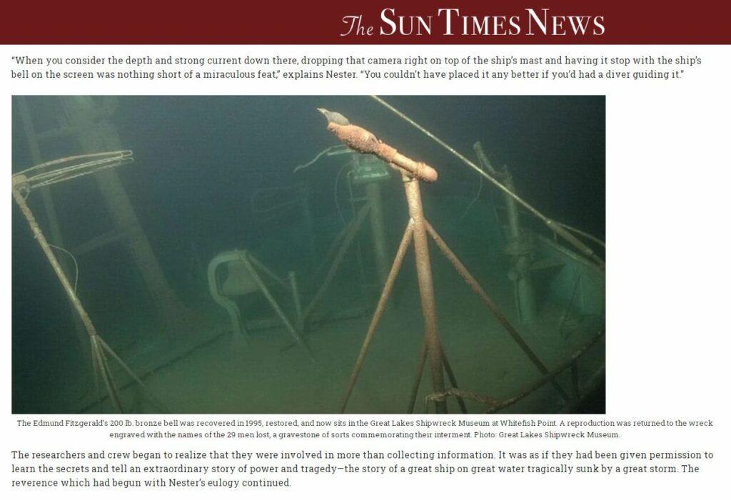
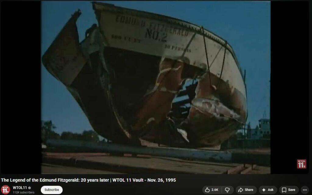
The U.S. Navy’s immediate and specialized involvement in the Edmund Fitzgerald sinking centered on its elite aerial detection and deep-water recovery technology. On November 14, 1975—just four days after the disappearance—a Navy Lockheed P-3 Orion aircraft equipped with a Magnetic Anomaly Detector (MAD) was deployed to the area. This technology, typically used for tracking submarines, was calibrated on a similar vessel carrying a matching cargo before locating a strong magnetic contact 17 miles north-northwest of Whitefish Point. The Navy remained vital to the investigation through May 1976, when its CURV III (Controlled Underwater Recovery Vehicle) was utilized to provide 43,000 feet of video tape and 900 high-resolution photographs that positively identified the wreckage. The Navy’s readiness to respond was largely due to its mission to maintain specialized search and rescue teams capable of reacting to maritime emergencies and major infrastructure failures at a moment’s notice.
The failure of navigational aids at Whitefish Point that night was highly atypical:
- RF Beacon and Lighthouse: At 4:30 PM on November 10, the Whitefish Point Light and its automated radio beacon both went offline due to a power failure caused by the storm. Historical records emphasize that the light had shined “more or less unfailingly for almost 150 years” except for the night the Edmund Fitzgerald went down, suggesting this was an extremely rare event rather than a common technical glitch.
- Radar Vanishing: While “sea return”—radar interference caused by high waves—is a known phenomenon during Great Lakes storms, the Fitzgerald’s disappearance from the Arthur M. Anderson’s radar at 7:15 PM was unprecedented in its finality. The ship’s “pip” had been intermittently obscured by sea return throughout the evening, but its permanent loss without a distress call indicated a catastrophic and abrupt event rather than routine interference.


In addition to the shore-based failures, several other electromagnetic and instrumental anomalies were reported that night:
- Total Radar Suite Failure: The Edmund Fitzgerald reported the total failure of both its long and short-range radar systems at 4:10 PM, effectively “sailing blind” into the worst of the storm.
- Intense Sea Return: The Arthur M. Anderson experienced such extreme radar interference that the snow and waves appeared as “giant blobs of white” on the screen, completely masking other vessels in the vicinity.
- Triangle Phenomena: Folklore and specialized investigations into the “Great Lakes Triangle” frequently cite “spinning compasses” and malfunctioning navigational instruments reported by other vessels in the corridor that night, though official logs focus primarily on the widespread power and radar failures.
Evidence of Collusion in Gordon Lightfoot song?
41:00 in — “Gordon took the words right from that [Newsweek] article and wrote that song.” It could be chance. It could be transmogrification.
“The song you hear on the radio is the first time any group every played it. Not a first-take; first-time ever.” 44:30 in — this is also extremely unlikely. “The guys in the band had never played it before, and they had never heard the words.” Several additional takes were attempted, but never turned out as good, reportedly. Hit the charts in Canada as #1 song; #2 in USA (#1 in USA was Barry Manilow, I WRITE THE SONGS). Profound sadness, emotion to cloud the bicentennial. Also Jesuit ploy.


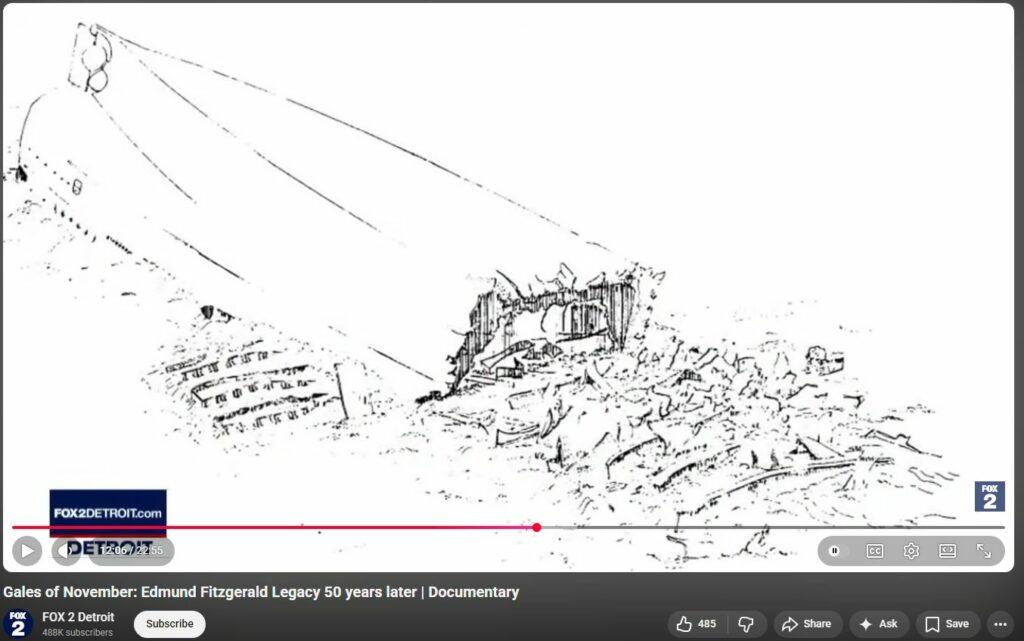
” The center of the ship disintegrated. “
12:10 into
https://www.youtube.com/watch?v=BdHTb_z5DQ0

“I just want to leave a clean campsite.” – Gordon Lightfoot


6,000 sinkings from 1875 to 1975 and not one since. More than once weekly for 100 years straight. Very Highly Sus.