Bridgewater Canal in Manchester possible DEW attack PROJECT MINOS test
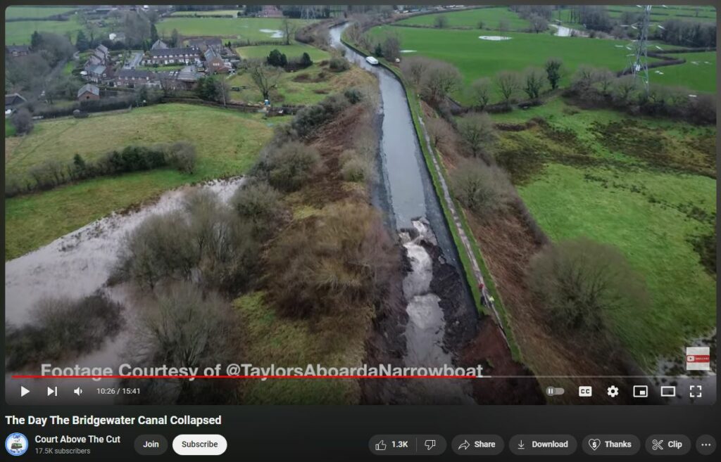
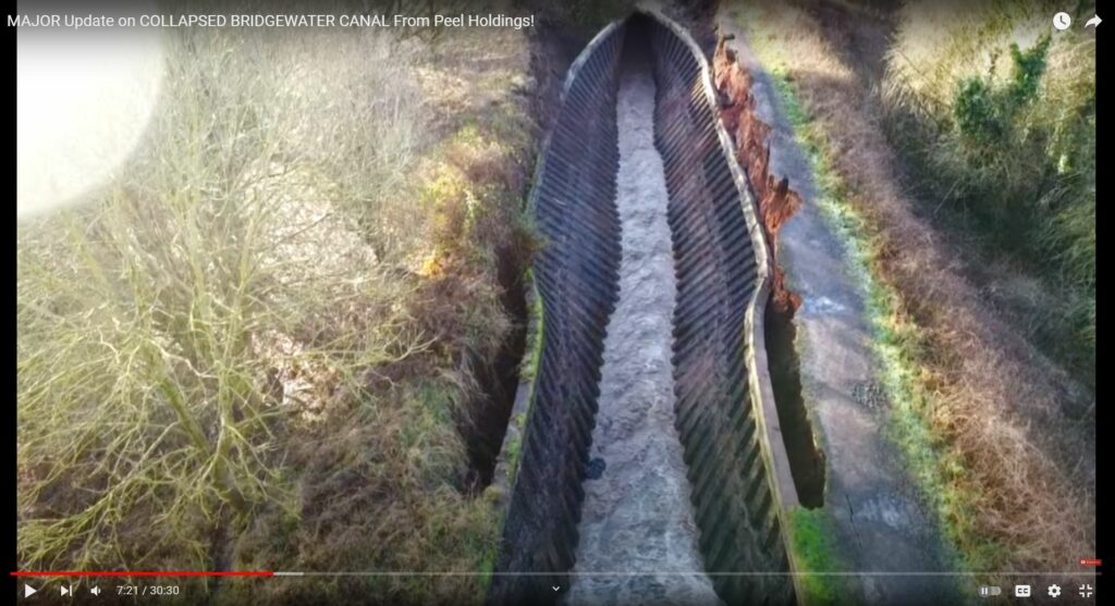
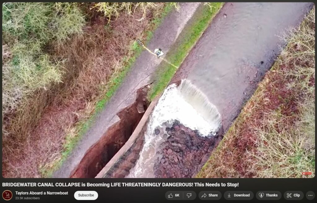
Oddly warped, wilted steel wall lining appears to be insta-rusted. Substantial portions of other steel wall lining appears to be completely vanished. Sudden failure appears to have begun inside the canal itself.
This is happening during an historic mass evacuation of Manchester due to (suspected) weather-warfaric man-made flooding.
There exists a DEW technology developed under PROJECT MINOS at Brookhaven National Labs and also Fermilab that can blast high-energy particle beams through solid matter. Particle-beam weaponry is no longer confined to atmospheric theater.
Moreover, the weapon attack velocity is speed-of-light (even through solid matter): D. Overbye (22 September 2011). “Tiny neutrinos may have broken cosmic speed limit”. New York Times. “That group found, although with less precision, that the neutrino speeds were consistent with the speed of light.
” (References section of https://en.wikipedia.org/wiki/MINOS)
https://en.wikipedia.org/wiki/MINOS
https://yandex.com/search/?text=project+minos+high+energy+physics
https://yandex.com/search/?text=project+minos+high+energy+physics%2C+%2Bbrookhaven
https://yandex.com/search/?text=project+minos+high+energy+physics%2C+%2Bfermilab
“Because they are weakly interacting and therefore usually pass through matter, the vast majority of the neutrinos travel through the near detector and the 734 km of rock, then through the far detector and off into space.” — Neutrino Beam section of https://en.wikipedia.org/wiki/MINOS
The Bridgewater Canal is described as the first great achievement of the canal age, although the Sankey Canal opened earlier. Bridgewater captured the public imagination because of its engineering feats; it required the construction of an aqueduct to cross the River Irwell, and a tunnel at Worsley. Its success helped inspire a period of intense canal building in Britain, known as Canal Mania. It later faced intense competition from the Liverpool and Manchester Railway and the Macclesfield Canal. Navigable throughout its history, it is one of the few canals in Britain not to have been nationalised, and remains privately owned. Pleasure craft now use the canal which forms part of the Cheshire Ring network of canals.
https://en.wikipedia.org/wiki/Bridgewater_Canal
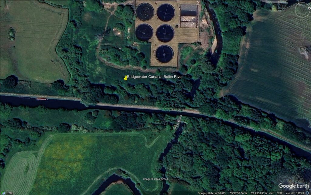
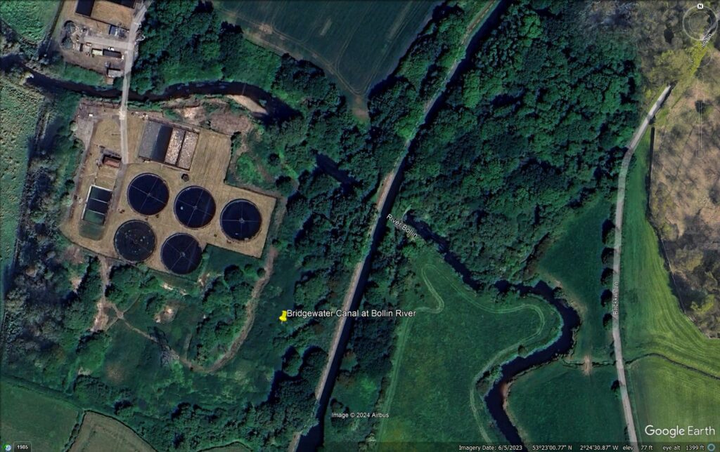
Manchester, England, area of Little Bollington, adjacent to River Bollin underpasses Bridgewater Canal
GPS LOCATION
https://www.google.com/maps/place/National+Trust+-+Dunham+Massey/@53.3824297,-2.4106619,324m
EVIDENCE OF NUMI / MINOS DEW ATTACK
Sudden onset, collapse.
Warped, wilted steel.
Symmetrical collapse of steel; possible missing material (akin to 911).
Apparent insta-rust.
Damage is on ‘leeward’ side; no apparent impingement of water reservoir (at the north side, opposite of fecal-filtering sewage plant); no apparent damage from collapsed wall, embankment or in-rushing river / flood water.
Apparent water erosion on the outsides of the steel wall lining, but no apparent source for water in sufficient volume or speed to causing wilting and symmetrical folding of the corrugated steel wall linings.
Perforating divets along towpath at even intervals, only atop the embankment. (see below)
CLUES SUSPECTED YET TO BE FOUND (after water level recedes)
Steel “burned-through” with holes, or otherwise inexplicably melted away.
Oddities in local geological formations (molten rocks, vitrifications, remnant radiation, etc). Note that rampant byproduct of RHIC “ion gun” at Brookhaven National Labs (BNL) is tritium.
Inexplicable damage to nearby structures, etc due to neutrino energy beam.
RE the tritium contamination at Brookhaven, seemingly plausibly likely also at MINOS strike points:
In the mid-1990s, Brookhaven National Laboratory (BNL) faced significant challenges due to tritium contamination from its High Flux Beam Reactor, which led to legal actions by local residents. The following resources provide detailed information on the contamination and subsequent lawsuits:
- “BNL heads to trial over impact of contamination after final settlement fails”: This article discusses the progression of a lawsuit initiated in 1996, alleging that radioactive discharges from BNL caused health issues in nearby communities. It details settlement negotiations and the decision to proceed to trial after nearly 25 years.
https://greaterlongisland.com/suffolk-closeup-bnl-contamination-trial/ - “20 Year Old Class Action Lawsuit on Radioactive Contamination Finally Moving Forward”: This piece covers the advancement of a class-action lawsuit against BNL, highlighting the legal battles and the exclusion of certain contamination claims from the case.
- https://www.nationofchange.org/2016/02/02/20-year-old-class-action-lawsuit-on-radioactive-contamination-finally-moving-forward/
- “A Nuclear Story”: This article provides an overview of the lawsuit against BNL, discussing the history of the case and the challenges faced by the plaintiffs in seeking justice for the alleged contamination.
https://www.counterpunch.org/2016/02/01/a-nuclear-story/ - “Suffolk Closeup: Brookhaven National Laboratory to be tested in court”: This column examines the long-standing lawsuit against BNL, detailing the legal proceedings and the community’s concerns about environmental contamination.
https://shelterislandreporter.timesreview.com/2016/01/17/suffolk-closeup-brookhaven-national-laboratory-to-be-tested-in-court/ - “Laboratory Loses Federal Contract”: This news article reports on the U.S. Department of Energy’s decision to terminate BNL’s contract due to environmental violations, including the tritium leak, and mentions the associated lawsuits.
https://www.thecrimson.com/article/1997/5/21/laboratory-loses-federal-contract-pin-fallout/
These resources offer comprehensive insights into the legal and environmental issues surrounding BNL’s tritium contamination and the residents’ lawsuits.
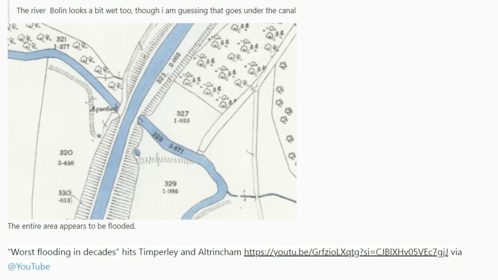
“It breached in exactly same place in 1971. The outflow from the canal has gone into to the Bollin [River] about 20ft below and will drain into the Mersey/Ship Canal.”
“Caused by relentless geoengineering. It’s the same in S Wales. There’s nothing natural about the weather we’re experiencing. We last saw the sun in September and then it was only very briefly.”
“DEWISH organization site evaluating this as PROJECT MINOS DEW attack testing under plausible cover of weather”
Comments to https://www.youtube.com/watch?v=COEOykDh1j8
1971 Bridgewater Canal sprang a leak near Bollin Aqueduct and a hole 90’ wide developed leading to closure of the canal. It signalled the end of most freight traffic over the canal.
https://bridgewatercanalguidedtours.com/about/bridgewater-canal-timeline/
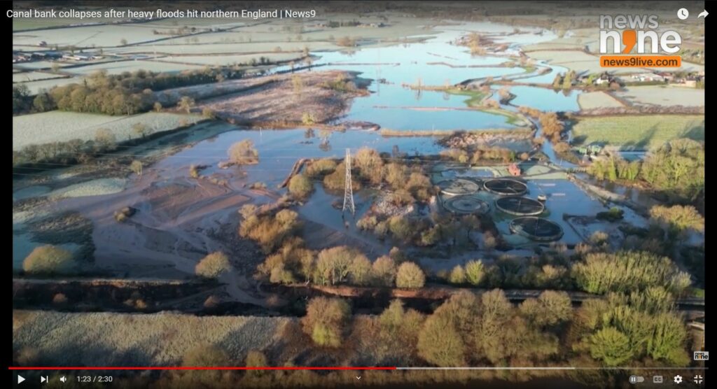
BELOW: Overview of wilted, symmetrically-collapsed, and apparently insta-rusted corrugated steel wall linings. When the Bollin River water recedes, it will (likely) be found that the steel aqueduct carrying the Bridgewater Canal over the Bollin River also has ‘impossible’ damage inexplicable without involving the application of NUMI/MINOS DEW.
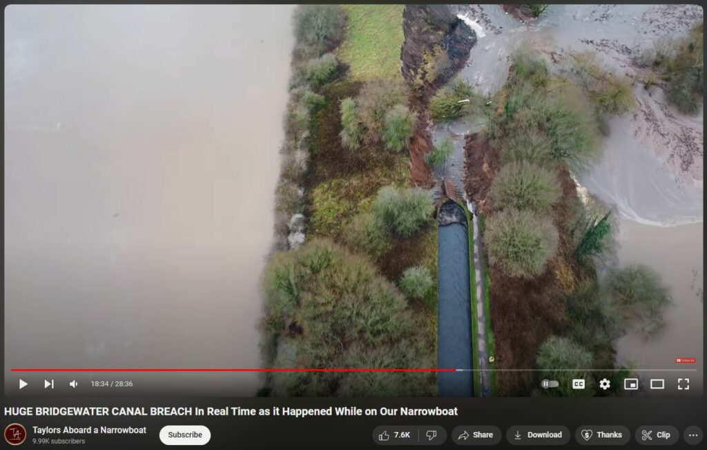
BELOW: The canal had kept going on-level, across over-top of the Bollin River. What melted the steel wall linings, if not entire aqueduct, and melted it symmetrically?
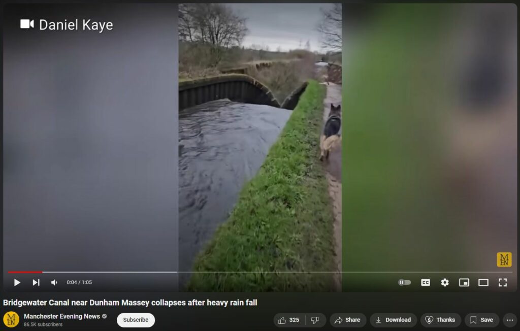
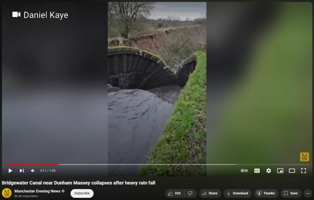
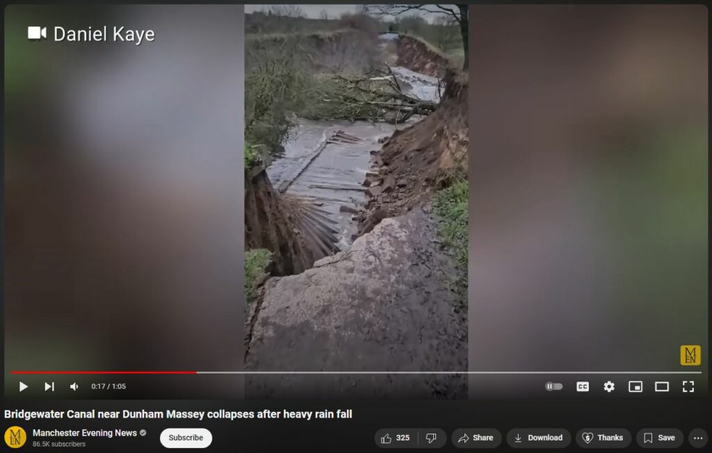
BELOW: Breach, showing east side sans corrugated steel wall lining. Was it used only at the canal’s overpass of Bollin River?
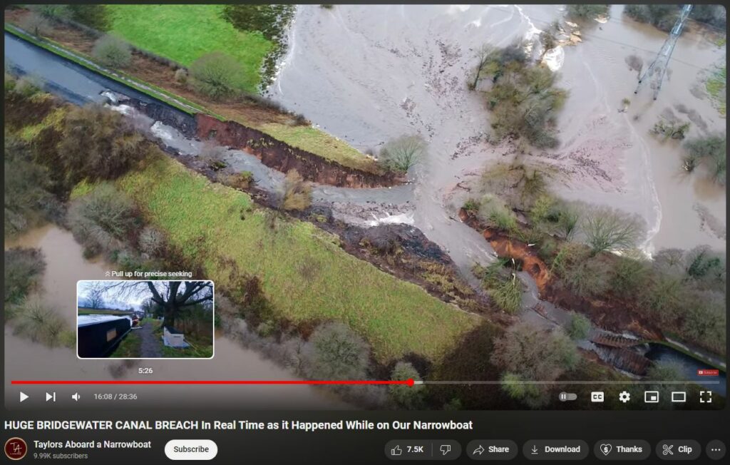
Evidence for weather warfare:
“I was working a night shift last night in south Manchester close to there, and all I can say is that the rain was BIBLICAL. “
“The point of failure was immediately south of the new concrete narrow section. The bit that failed in 1971 (and took 3 years to fix!) appears to be fine at the moment. Interestingly a customer at the No 3 messaged me asking how the levels were, as they were on the bottom. The canal at both Preston Brook and in Leigh were topping the banks which gave the game away. I did message the engineer to let him know but probably somebody got there before me as they were quick to get on site.”
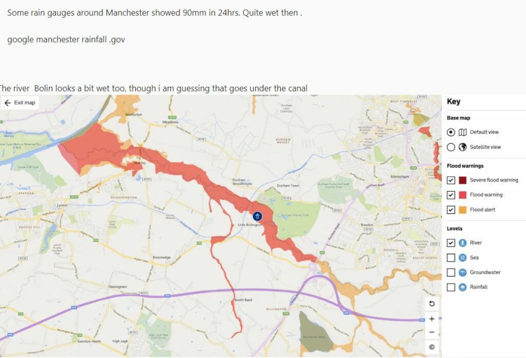
“Some rain gauges around Manchester showed 90mm in 24hrs. Quite wet then . google manchester rainfall .gov”
https://www.canalworld.net/forums/index.php?/topic/123363-bridgewater-canal-breach/
Again: Described as “a bomb had gone off” —
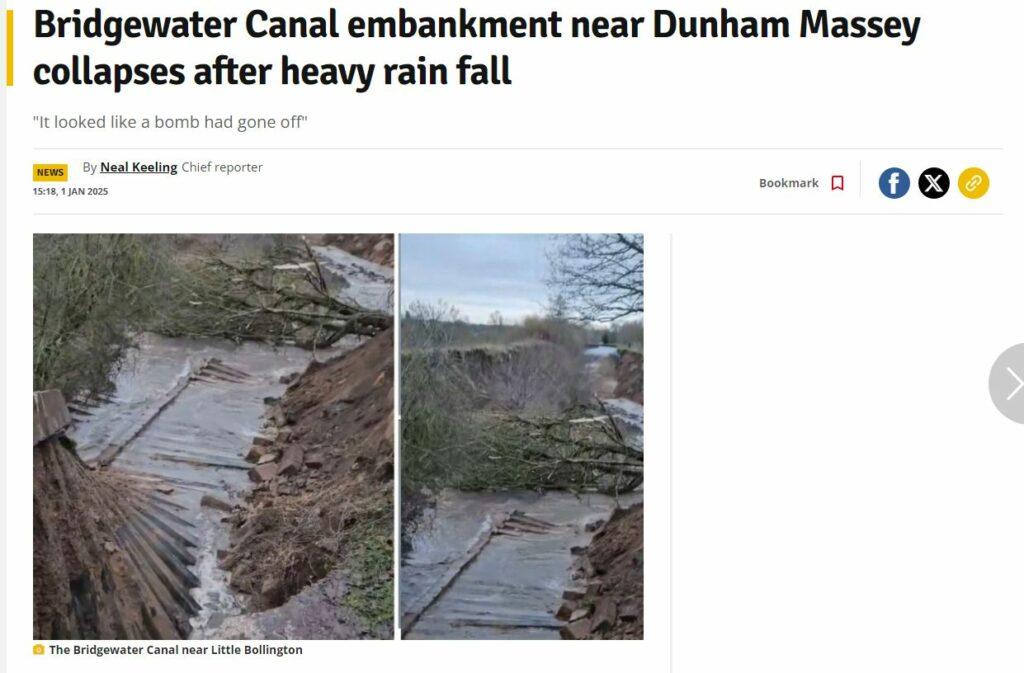

Of course, the fact that another breach happened nearby (perhaps in essentially the same place) back in 1971 strongly indicates that nearly this entire post may turn out to be speculative, imaginative hogwash. Regardless: PROJECT MINOS and the thru-matter DEW is real. Let’s look there before giving up…
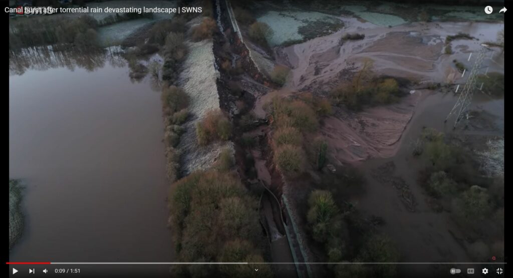
Location of Breach
But there is the oddity of the location of the breach, immediately after the narrowed, steel-lined portion, in the middle of the embankment…and what appears to be either a withering of the foliage or else a morning frozen dew (pardon the pun). Note zero evidence of any ‘wash over’ or ‘overflow’ from the upstream (to the left of image) into the canal; rather, it’s as if the walls of the canal were weakened, melted, warped, wilted, and the towpath ‘perforated’ by energy /neutrino beam to cause or perhaps pre-emptively allow breach.
BELOW: Notice downstream / right-side towpath is ‘perforated’ with evenly-spaced divets, perhaps made by NUMI MINOS NEUTRINO ENERGY BEAM to weaken the embankment? The divets appear nowhere else…no doubt another Total Coincidunce!
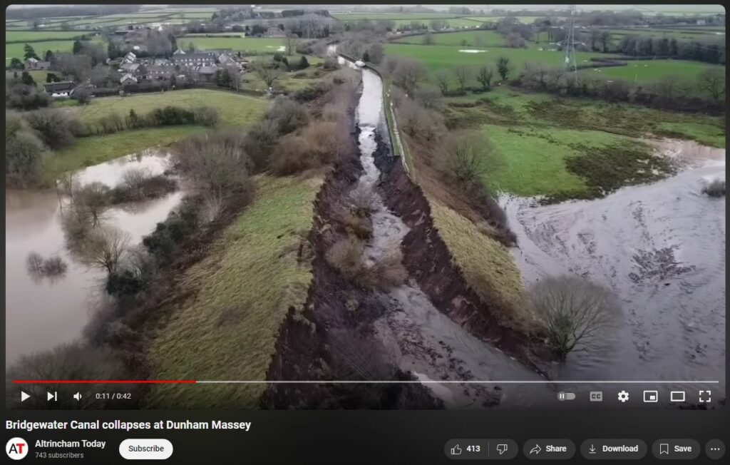
BELOW: Curious that divets would be relatively evenly spaced along the towpath, yet not visible elsewhere…almost as if some energy or neutrino beam had been used to “perforate” the ground and weaken it to allow potential breach…
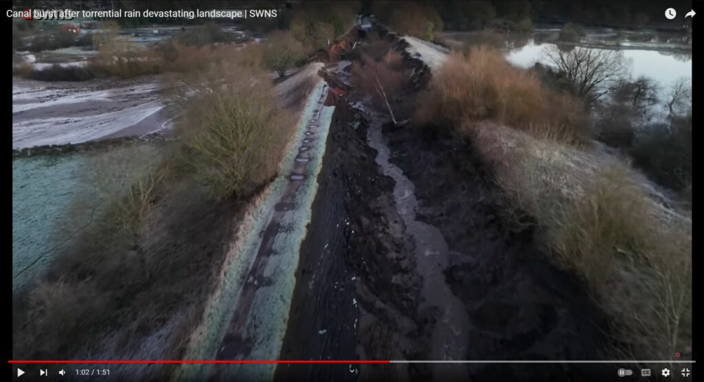
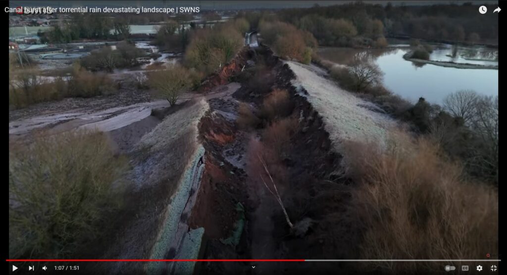
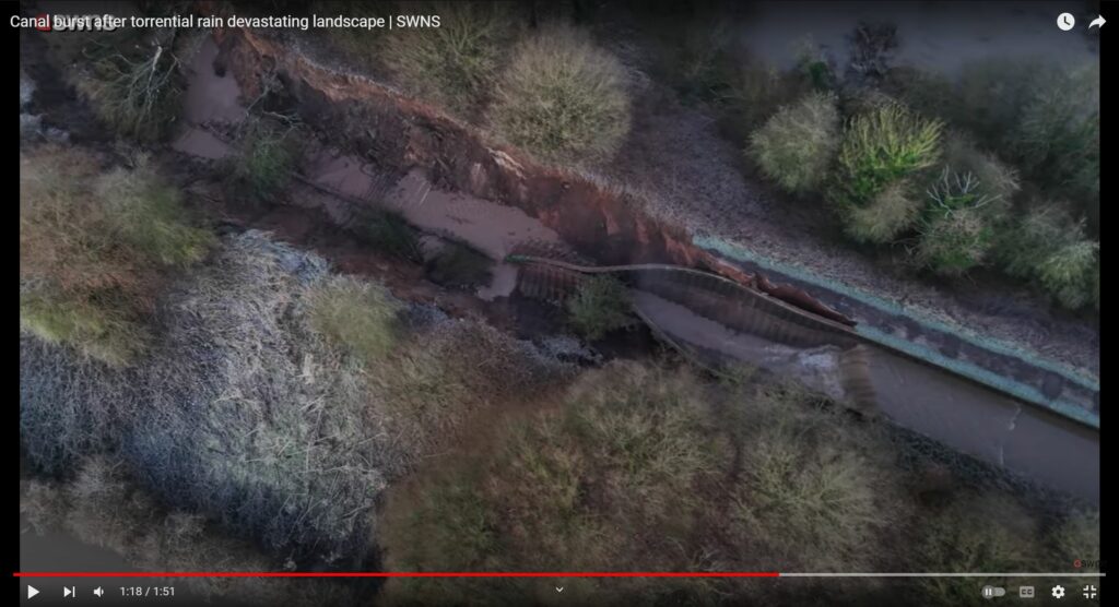
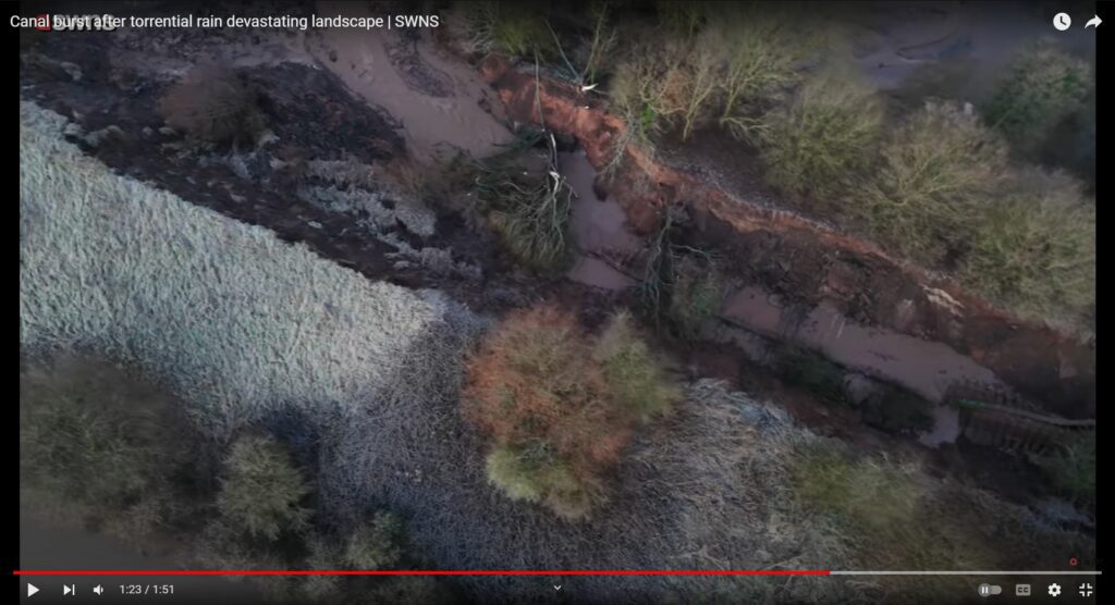
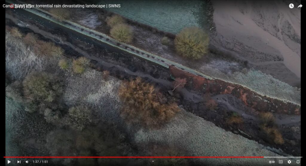
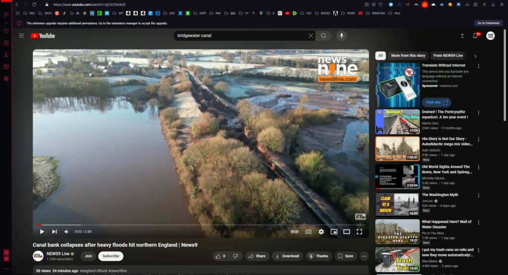
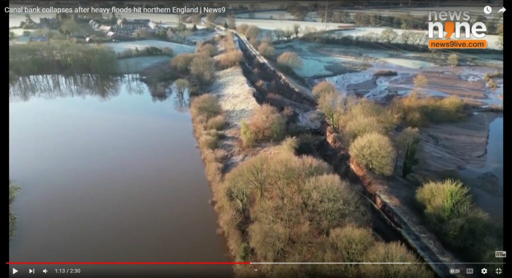
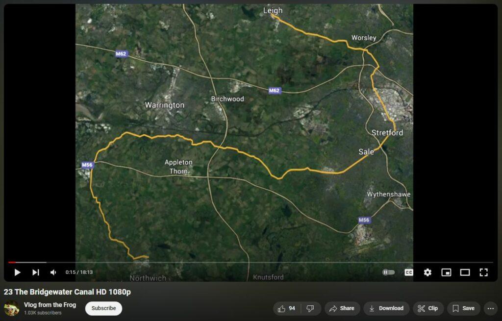
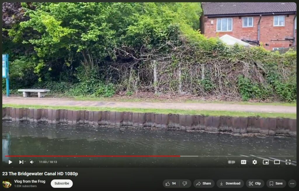
BELOW: Corrugated steel wall linings are common along the Bridgewater Canal.
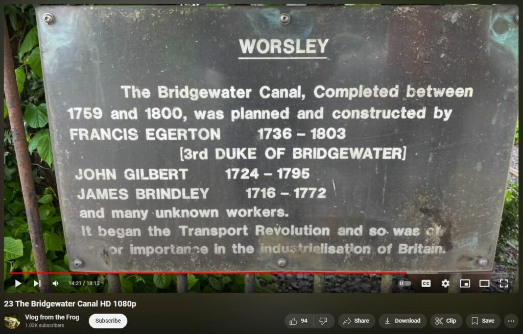
BELOW: Just for fun.
There is also the Total Coincidunce of this:
list particle accelerators near bridgewater canal at bollin river and list their directions and distances from crossing of bollin river underneath bridgewater canal
The Bridgewater Canal crosses the River Bollin near Dunham Massey in Greater Manchester, England. While there are no particle accelerators immediately adjacent to this location, several notable facilities are situated within the United Kingdom. Here are some of them:
Warrington, Cheshire, UK
Home to accelerator facilities such as the Synchrotron Radiation Source (SRS), which operated until 2008, and ongoing accelerator research and development programs.
Warrington, Cheshire, UK
Located at the Daresbury Science and Innovation Campus, focusing on advanced accelerator science and technology.
Harwell, Oxfordshire, UK
The UK’s national synchrotron light source, operational since 2007.
Harwell, Oxfordshire, UK
A world-leading center for research in the physical and life sciences, utilizing a proton accelerator to produce neutron and muon beams.
These facilities contribute significantly to scientific research and development in the UK. For a comprehensive and up-to-date map of particle accelerators worldwide, including those in the UK, you can refer to the International Atomic Energy Agency’s Interactive Map of Accelerators.
And this —
which of these facilities is also involved with project minos
The MINOS (Main Injector Neutrino Oscillation Search) experiment was a collaboration primarily involving institutions in the United States and the United Kingdom, focusing on studying neutrino oscillations. Among the facilities you mentioned, the Daresbury Laboratory in Cheshire, UK, was notably involved in the MINOS project. Researchers from Daresbury contributed to the construction and operation of the experiment, particularly in the development of detector technologies and data analysis.
I MEAN, WHAT A — T O T A L — C O I C I D U N C E
The Cockcroft Institute, also located at the Daresbury Science and Innovation Campus, focuses on advanced accelerator science and technology. While the Cockcroft Institute is involved in various international collaborations, its direct involvement in the MINOS project is not prominently documented.
The Diamond Light Source and the ISIS Neutron and Muon Source, both situated at the Harwell Science and Innovation Campus in Oxfordshire, are primarily dedicated to synchrotron light and neutron research, respectively. There is no documented involvement of these facilities in the MINOS experiment.
In summary, among the facilities listed, the Daresbury Laboratory was actively involved in the MINOS project.
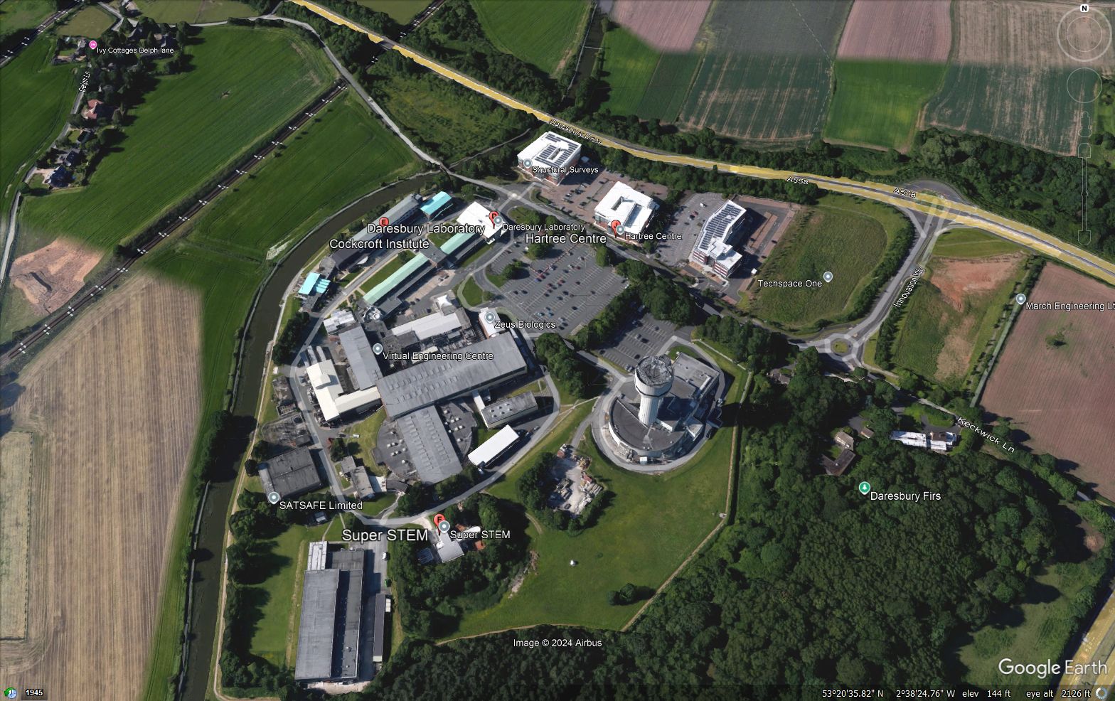
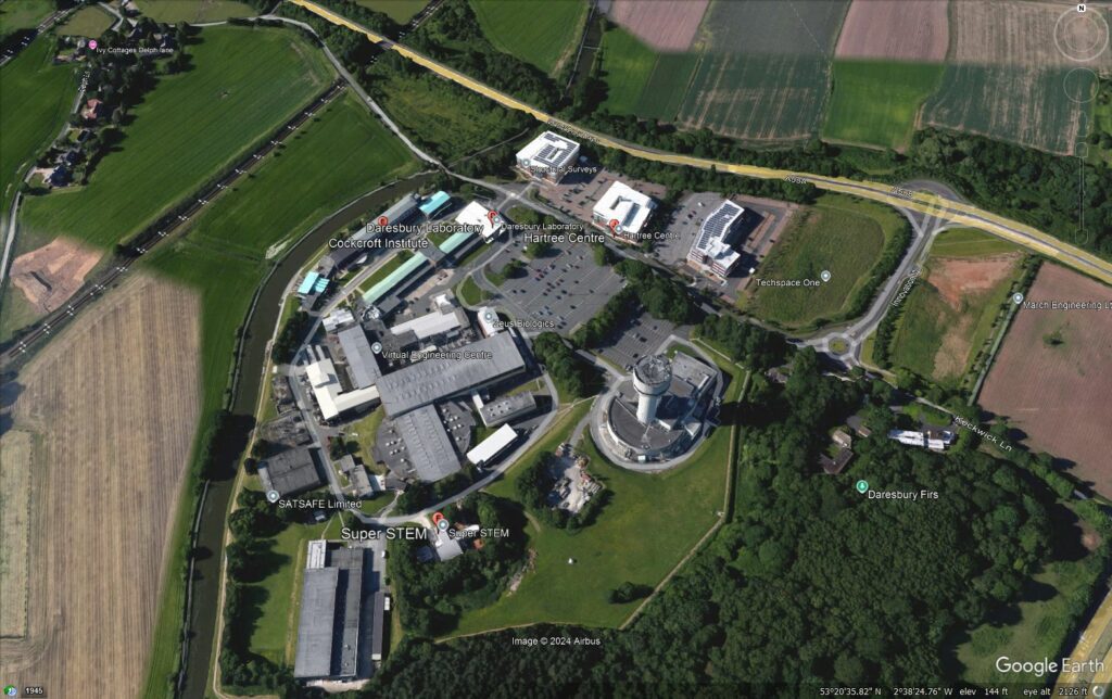
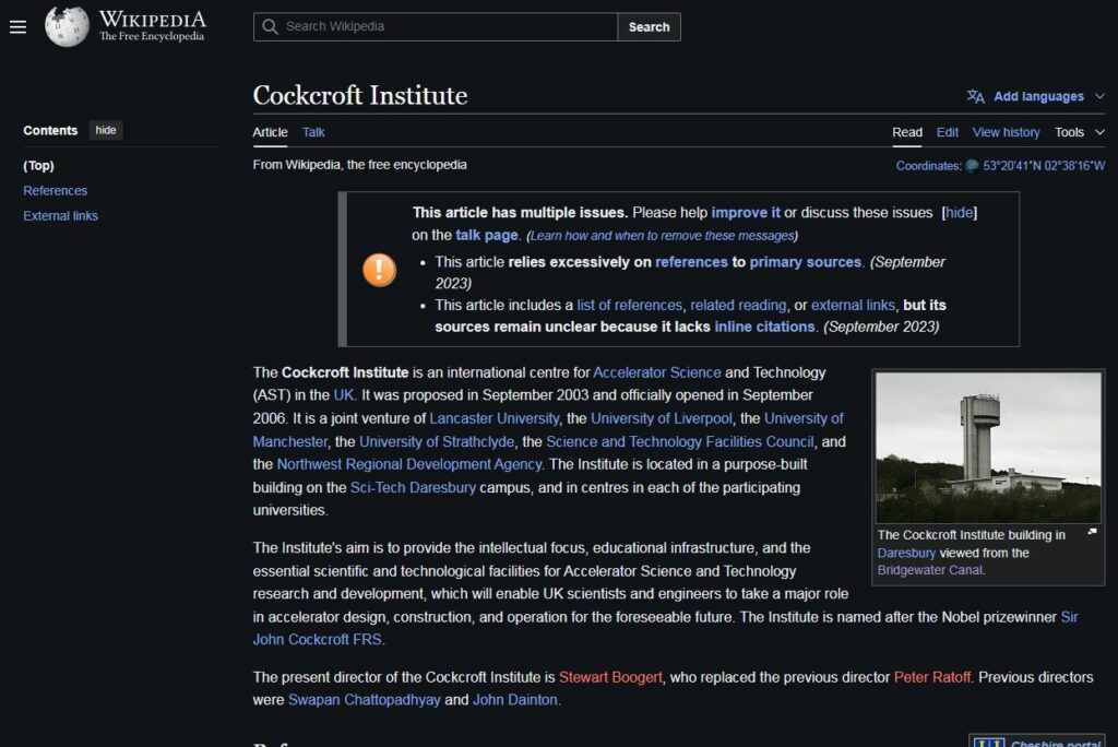
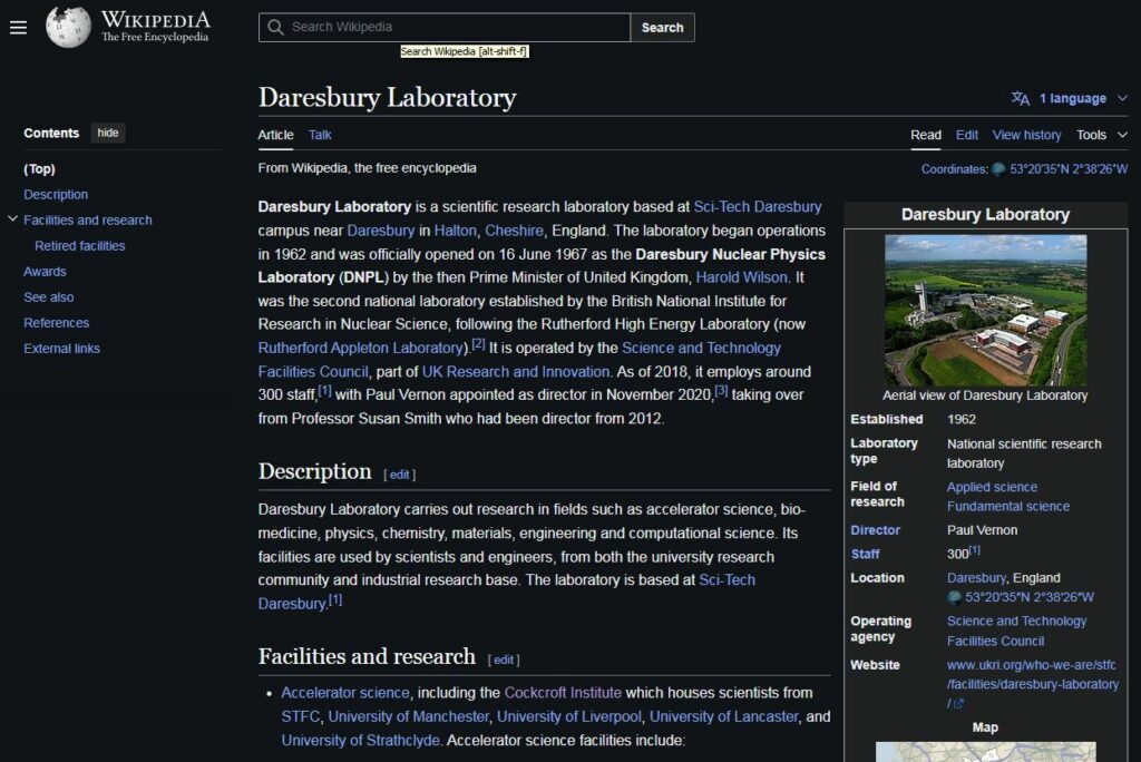
BELOW: Daresbury and Cockcroft (per Cockcroft ultra-voltage multiplier infamy, no less! https://en.wikipedia.org/wiki/Cockcroft–Walton_generator ) are literally rock-toss next-door neighbors, same campus, same street, same style buildings. Likely hand-in-hand military weapons research partners.
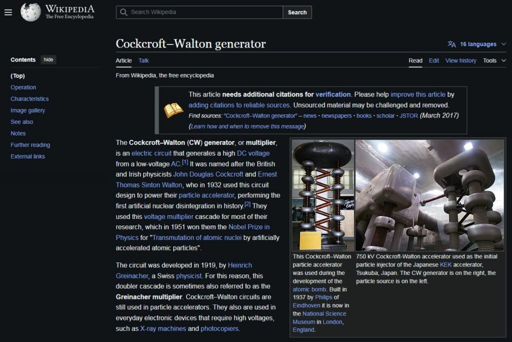
BELOW: Ultra-high voltage multiplication via Cockcroft-Walton generator — https://en.wikipedia.org/wiki/Cockcroft–Walton_generator
https://en.wikipedia.org/wiki/Cockcroft_Institute
https://en.wikipedia.org/wiki/Daresbury_Laboratory
BELOW: Easily within sight and MINOS DEW beam shooting distance!
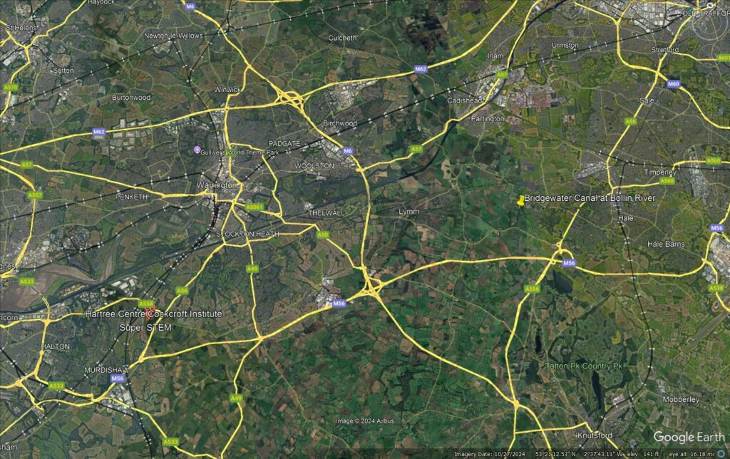
BELOW: Numerology, check! 9.83 miles (or numerologically, 9.11) at an angle of 74.74. Wonder what gematrically significant current events are garnering the number 74 lately…must check Zachary K Hubbard next.
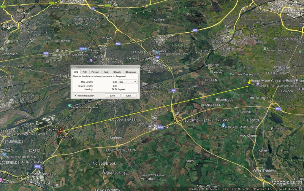
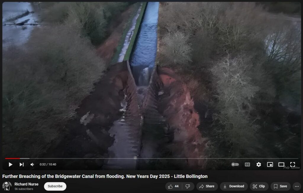
I’m pretty sure ‘you couldn’t make this stuff up’…So, based on the overall evidence presently available, my best bet is PRO ‘conspiracy’ and the intimate involvement of MINOS DEW in what appears to be some kind of test + attack at Bridgewater Canal at Bollin River.
Divets in Towpath may indicate Energy Beam attack
BELOW: Notice divets along towpath. Energy beam attack points, to weaken the soil?
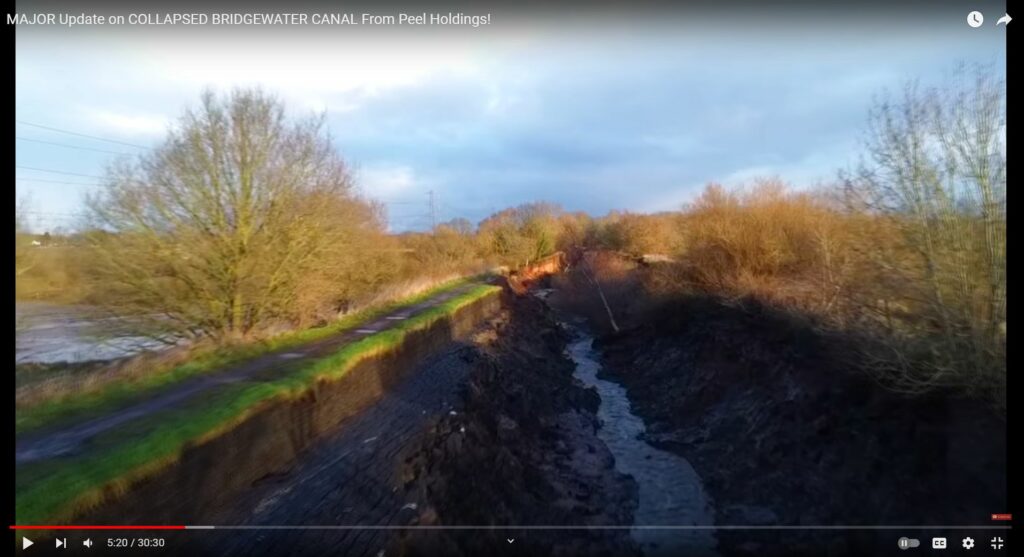
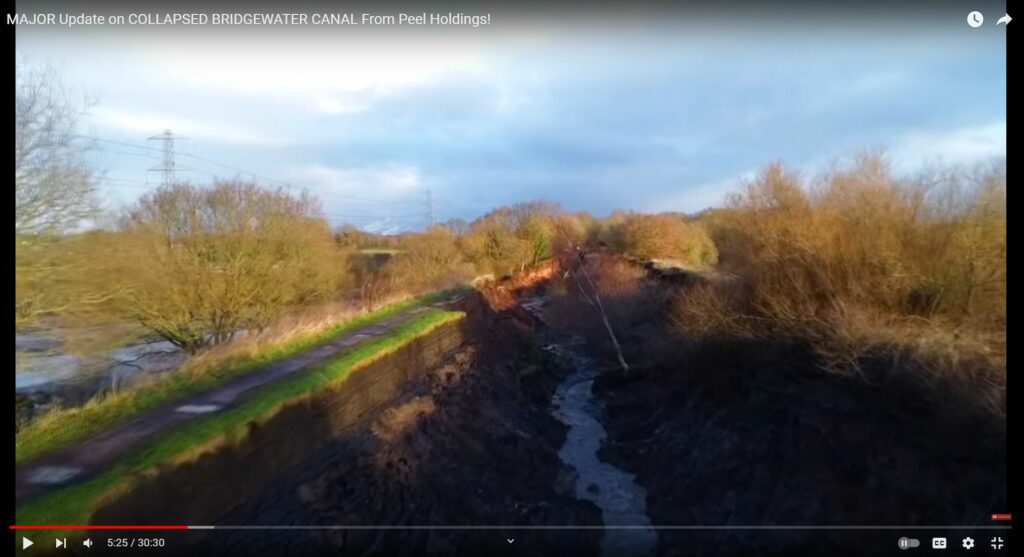
BELOW: Notice the abrupt cut into the soil at the towpath. Similar on other side, too. Seems odd, as if not done by water but possibly energy beam.
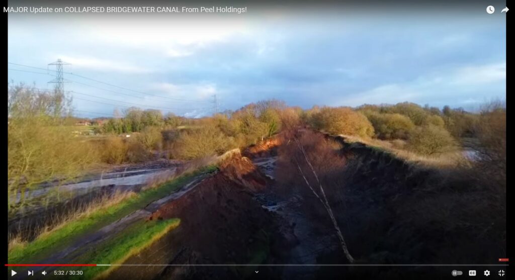
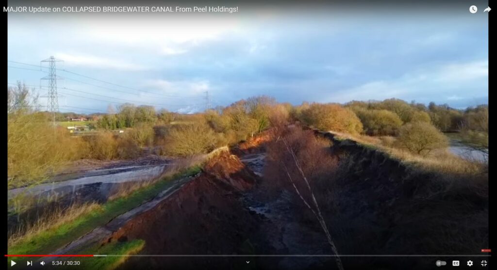
BELOW: That uniform, symmetrical collapse of the steel wall lining is SO STRANGE. No way was enough water pushing them inward; instead, it appears as if the two opposing walls were somehow magnetically attracted to each other.
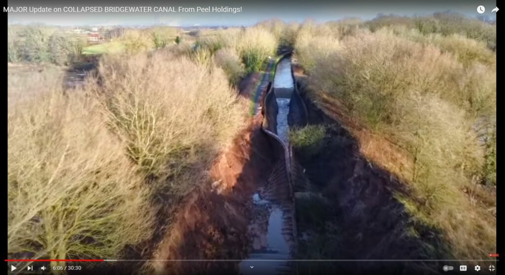
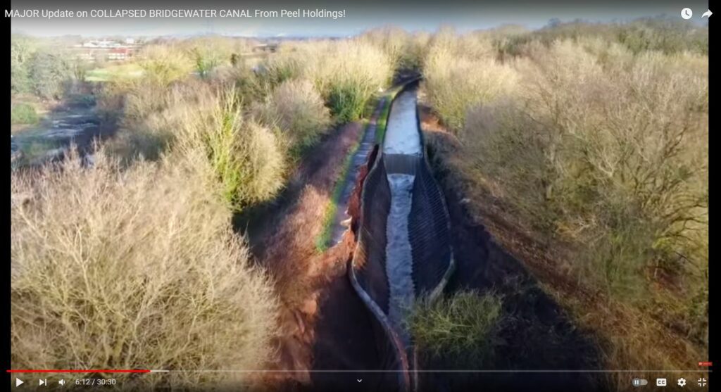
BELOW: Same as other side: Abrupt cuts into the soil, as if by energy beams. Where did enough water, let alone any water, come from, in speed and quantity necessary to cause incredible warping of steel wall linings, against the forces of earth and water.
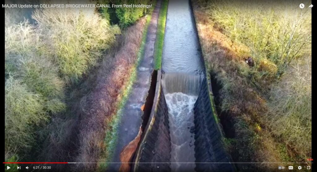
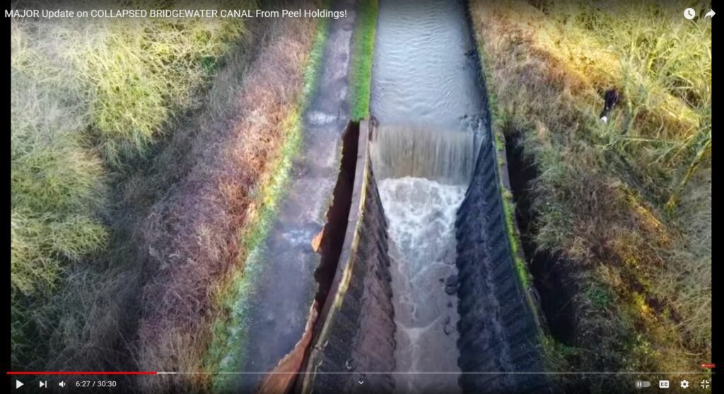
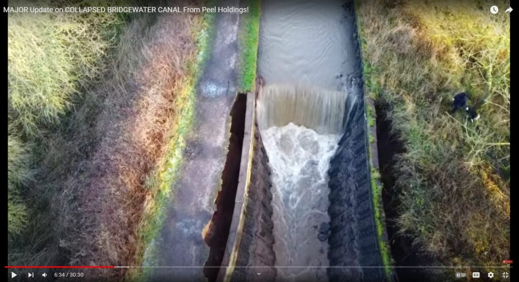
BELOW: 7:09 where did enough water, let alone any water, come from in order to wash away both banks and then also cause symmetrical wilting and warping of the steel wall linings. Something is VERY WRONG here. Energy weapons attack? DEWISH organization site has an unique alt theory with evidence from other attack sites.
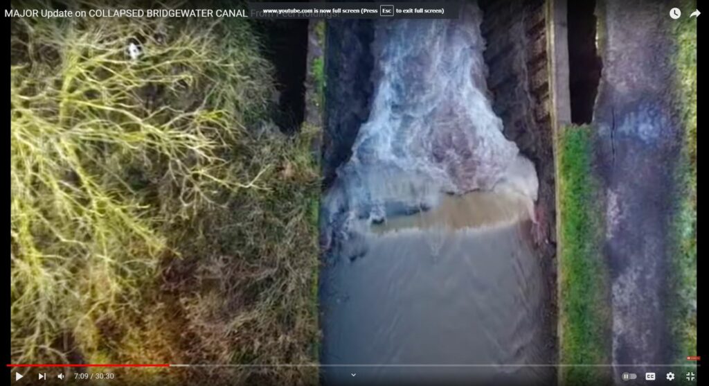
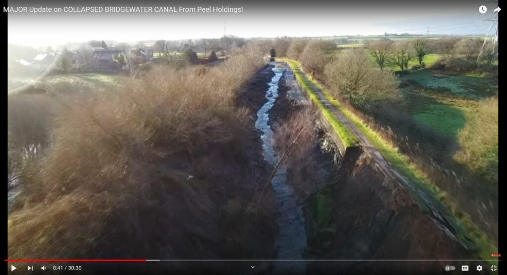
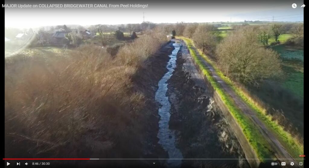
BELOW: Odd holes in embankment, lower right.
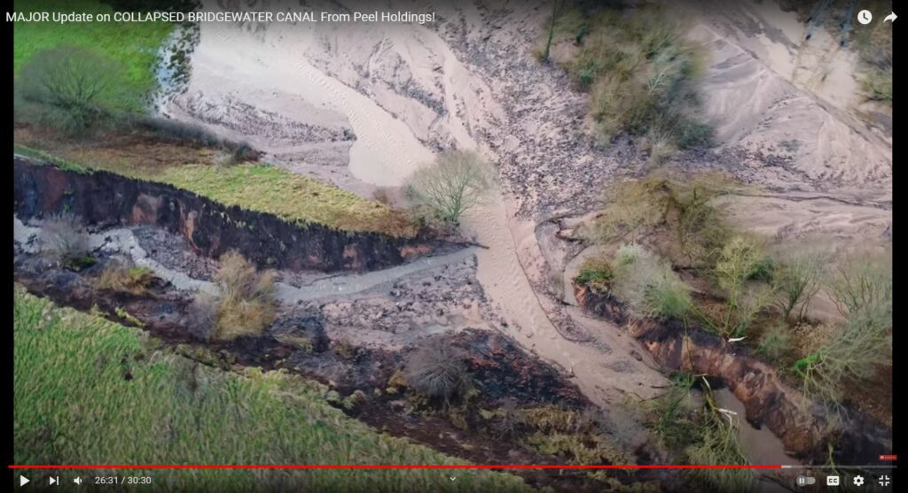
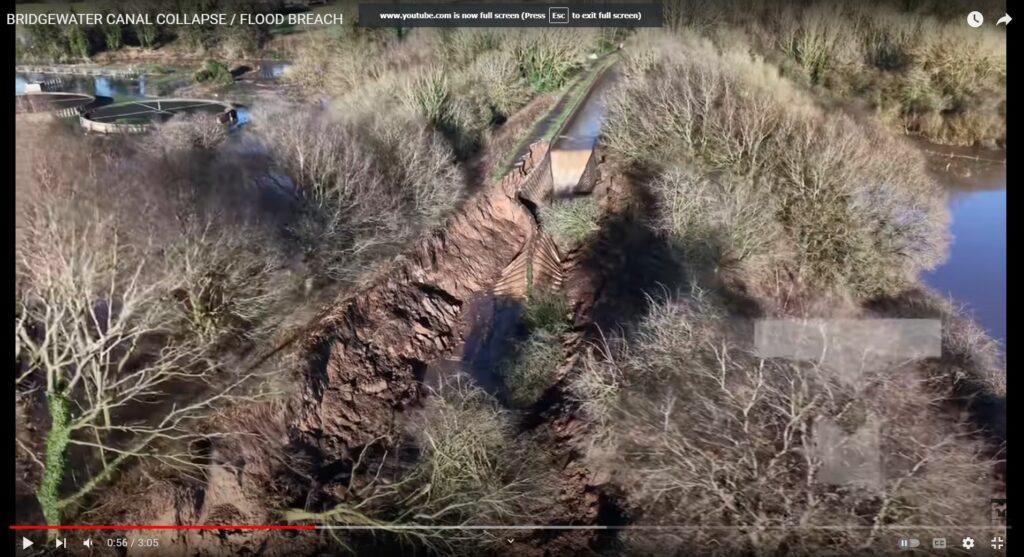
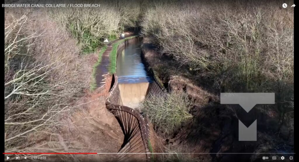
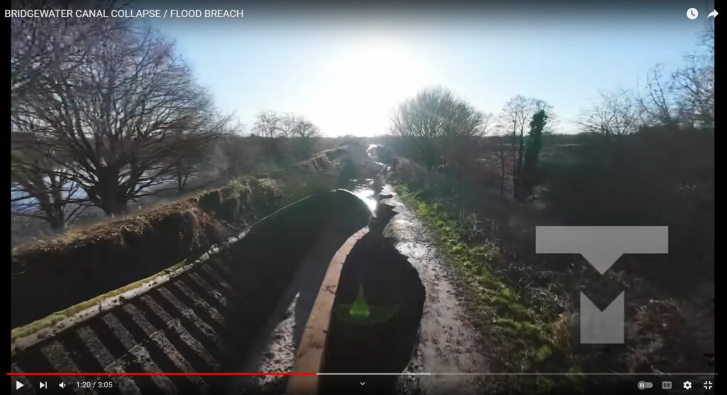
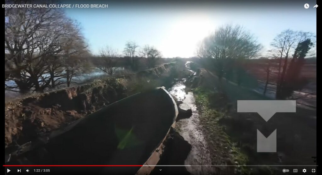
BELOW: Is that fractured steel runner at the top? This steel wall lining was installed presumably in 1971 to strengthen the canal after the breach at this location at that time.
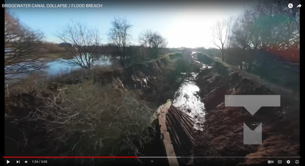
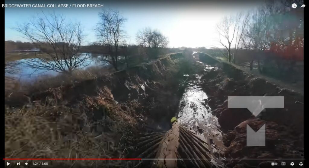
BELOW: Uniformly spaced divets in the towpath, evidence of weakened earth? Possibly displaced by energy beam? Or natural?
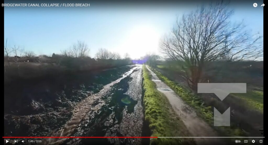
5 Jan 2025 Update
Steel-side continues to erode; however, note that the steel wall lining is collapsing in a bottoms-meet-first. When the canal was filled, how did the tops stretch to meet? The meeting tops (despite canal full of water) could indicate an electromagnetic attraction, perhaps caused by MINOS / DEW. Just speculating to explain the otherwise seemingly inexplicable evidence.
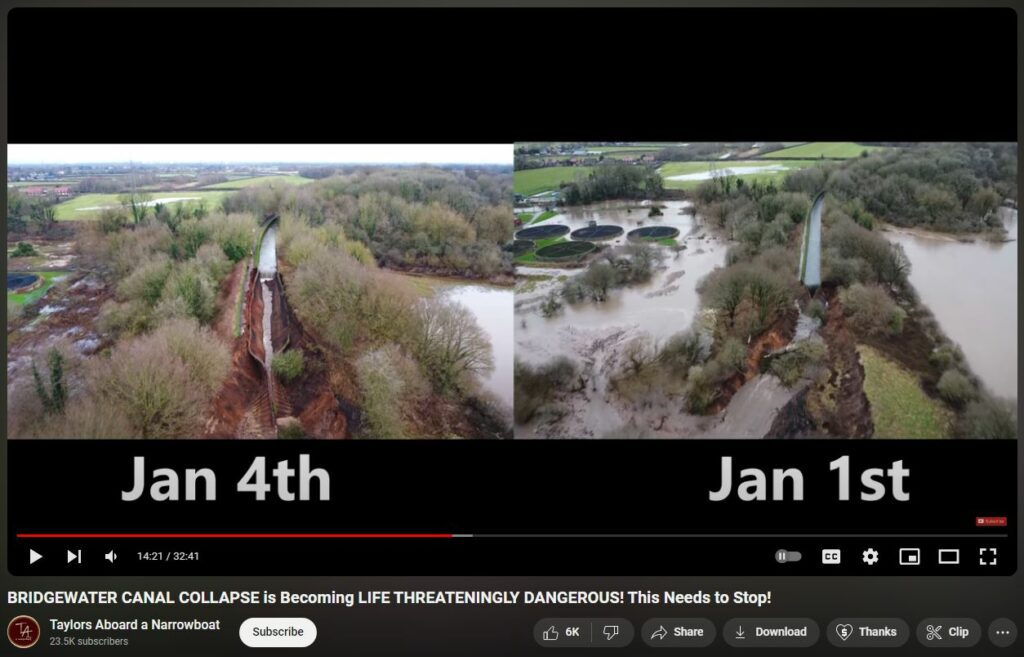
Note the short distance between eroded underwater cliff vs the touching steel wall lining from the day-after video —
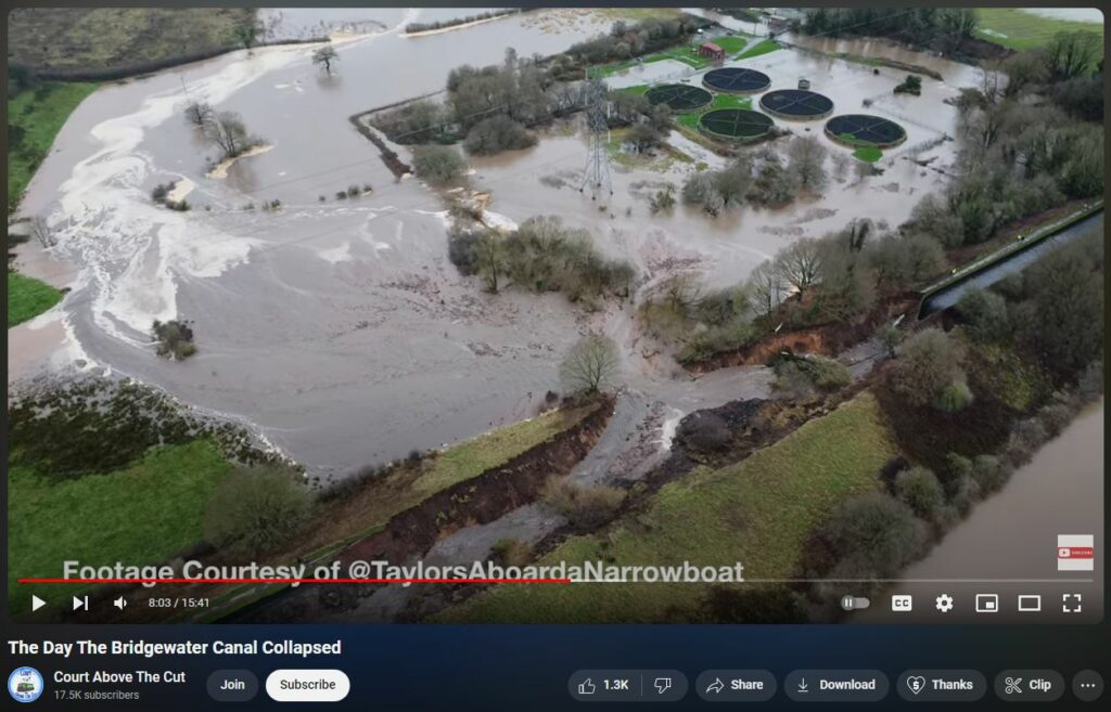
The underwater eroded cliff has continued to erode back away from the steel wall linings touch-point.
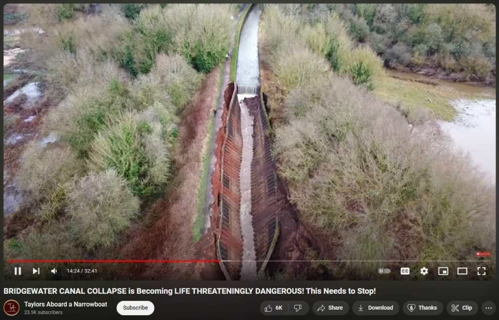
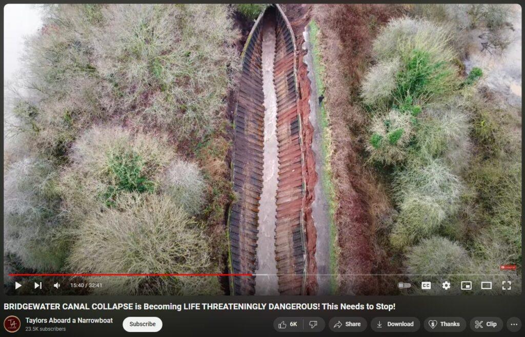
Notice the video captures erosion outside the steel wall lining —
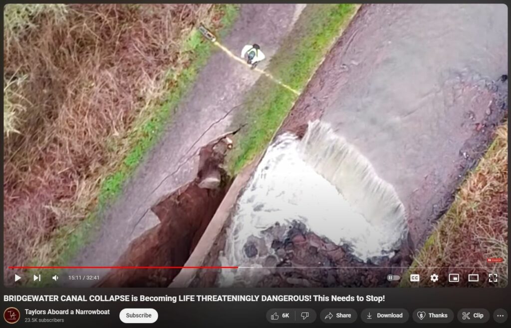
Also, this is an excelent ‘normie’ explanation —
Hi Stephen. You mentioned that this breach is the same place as 1971. I think it’s very near to the same place. In the photo you show (which is available in colour) one can see the brickwork for the Bollin Aqueduct on both sides of the canal immediately next to the 1971 breach. The houses in the distance seem to match Bollington, and the pylon matches. Checking the National Library of Scotland side-by-side maps, these features were present in the historic maps. Checking google imagery, the style of the buildings we see match Bollington rather than those in the Dunham Woodhouses direction. So, I’m fairly certain that the 1971 breach was on the eastern side of the canal immediately to next to the south of the River Bollin Aqueduct, whereas this is in the western side to the south of the sewage farm. I think we can see the 1971 repair in the Taylor’s videos – it’s the section which is narrower than the rest of the canal with the sheet piling, some of which has fallen inwards as the canal bed erosion continues to moving north. Your suggestion of a leak into the culvert seems to, erm, hold some water.
Studying the footage, historical maps, google maps, etc, I’m fairly certain that this breach is centred directly over the western side of the culvert [not the 1971 eastern location], which seems suspicious.
So, here is my theory (which is speculation with some reasoning): there was no leak from the canal into the culvert prior to the New Year’s storm. There wasn’t a “surge” on the canal that over-topped the bank. I think the water coming down the River Bollin started to flood near the mill, overtopping into the drain (we can see from Taylor’s footage that the area on the opposite side with the mill is completely flooded). That sent a lot of water through the culvert under the canal, which had a weakness on the western side. The water in the culvert started eroding the bank from beneath, reducing what integrity it had, until it had removed so much material that the pressure of the water above formed a hole between the canal and culvert below. At that point, the result was inevitable – the hole got bigger and bigger eventually taking down the side of the embankment.
https://www.youtube.com/watch?v=RmiulqQW9Rc
Also: The Canal & River Trust’s commercial income for the year ending March 31, 2024 was £97.1 million, which was 12.2% higher than the previous year. This represented 41% of the trust’s total income, up from 38.1% in 2022/23
